MyTopo
Crutcher Canyon Nevada US Topo Map
Couldn't load pickup availability
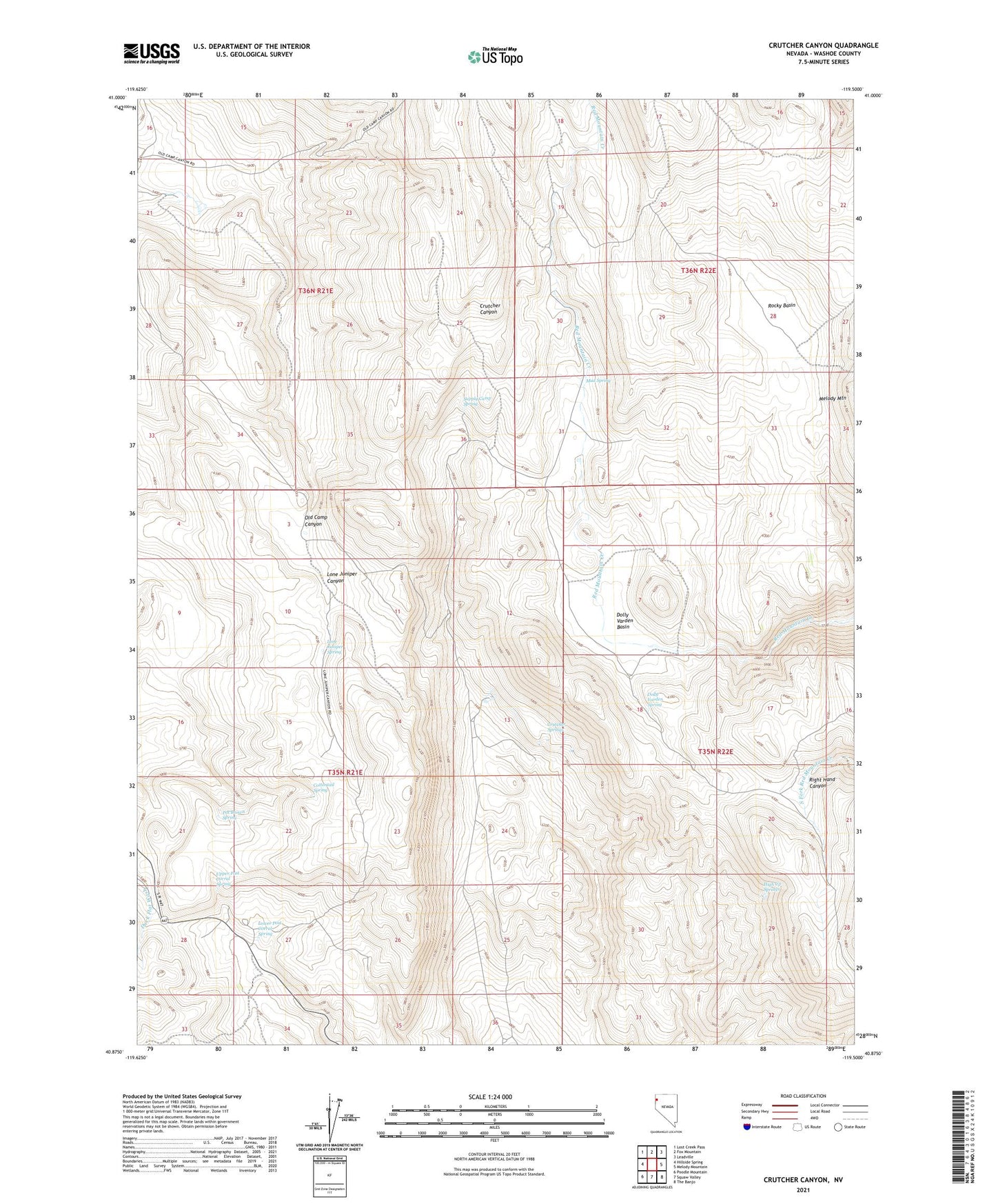
2021 topographic map quadrangle Crutcher Canyon in the state of Nevada. Scale: 1:24000. Based on the newly updated USGS 7.5' US Topo map series, this map is in the following counties: Washoe. The map contains contour data, water features, and other items you are used to seeing on USGS maps, but also has updated roads and other features. This is the next generation of topographic maps. Printed on high-quality waterproof paper with UV fade-resistant inks.
Quads adjacent to this one:
West: Hillside Spring
Northwest: Lost Creek Pass
North: Fox Mountain
Northeast: Leadville
East: Melody Mountain
Southeast: The Banjo
South: Squaw Valley
Southwest: Poodle Mountain
This map covers the same area as the classic USGS quad with code o40119h5.
Contains the following named places: Cottontail Spring, Crutcher Springs, Dolly Varden Basin, Dolly Varden Spring, High Up Springs, Lone Juniper Canyon, Lone Juniper Spring, Lower Post Corral Spring, Mud Spring, Old Camp, Pat Brown Spring, Rocky Basin, Supply Camp Spring, Upper Post Corral Spring