MyTopo
Deer Lodge Canyon Nevada US Topo Map
Couldn't load pickup availability
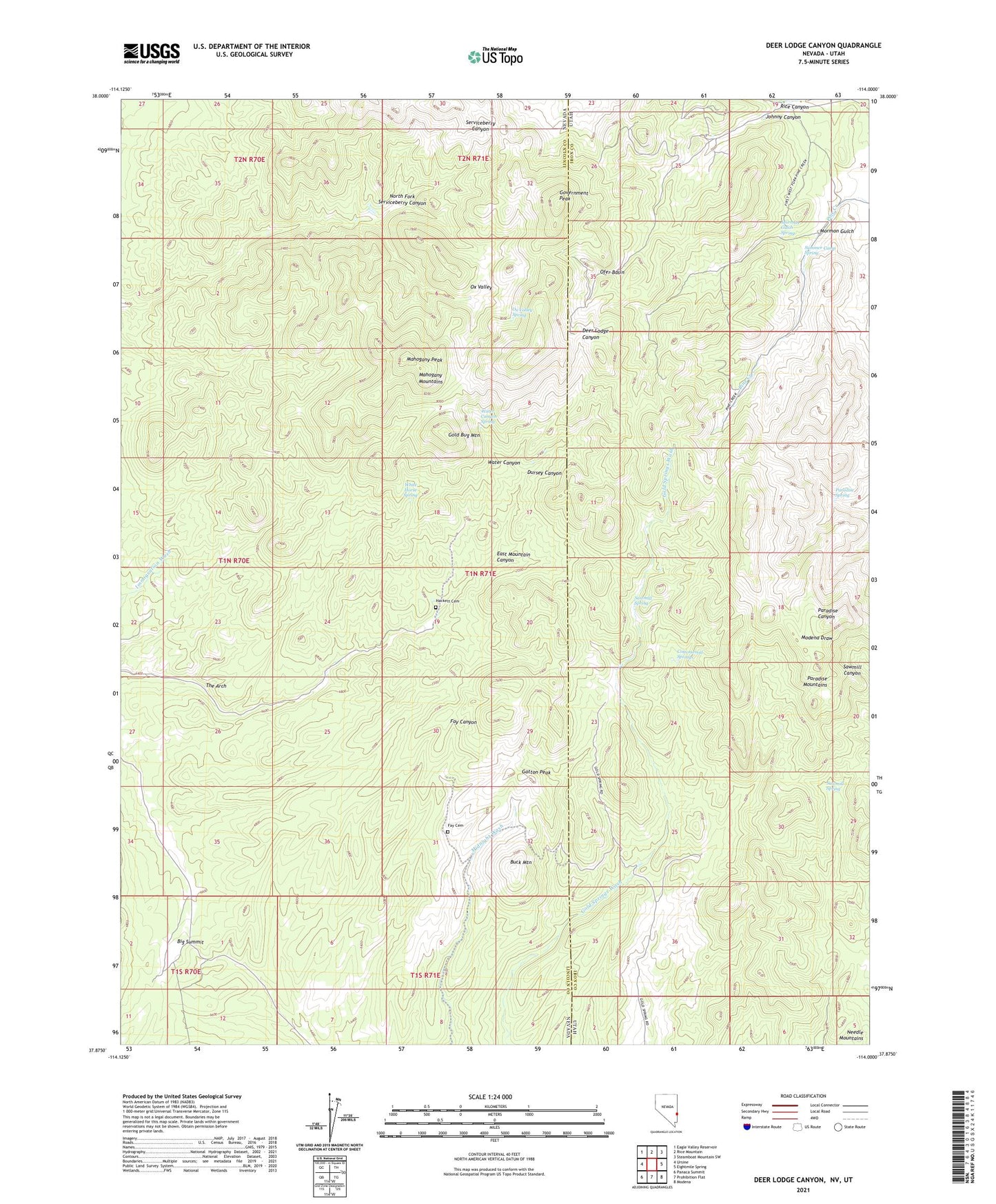
2021 topographic map quadrangle Deer Lodge Canyon in the states of Nevada, Utah. Scale: 1:24000. Based on the newly updated USGS 7.5' US Topo map series, this map is in the following counties: Lincoln, Iron. The map contains contour data, water features, and other items you are used to seeing on USGS maps, but also has updated roads and other features. This is the next generation of topographic maps. Printed on high-quality waterproof paper with UV fade-resistant inks.
Quads adjacent to this one:
West: Ursine
Northwest: Eagle Valley Reservoir
North: Rice Mountain
Northeast: Steamboat Mountain SW
East: Eightmile Spring
Southeast: Modena
South: Prohibition Flat
Southwest: Panaca Summit
Contains the following named places: Big Buck Mine, Big Summit, Buck Mountain, Charley Ross Mine, Cottonwood Springs, Deer Lodge, Deerlodge Post Office, Desert Springs, Dursey Canyon, Eagle Valley Mining District, East Mountain Canyon, Etna Mine, Fay, Fay Cemetery, Fay Post Office, Gatton Peak, Gold Bug Mountain, Gold Springs, Gold Springs Mining District, Government Peak, Gypsy Mine, Hackett Cemetery, Helen Mine, Homestake Mine, Horseshoe Mine, Independence Mine, Iris Mine, Jennie Mine, Johnny Canyon, Johnny Mine, Jumbo Mine, Little Buck Mine, Mahogany Mountains, Mahogany Peak, Mormon Gulch, Mormon Gulch Spring, Mountain View Mine, North Fork Serviceberry Canyon, Ofer Basin, Ofer Mine, Ox Valley, Ox Valley Spring, Paradise Mountains, Paradise Spring, Pikes Diggings, Pope Mine, Red Eagle Mine, Rice Canyon, Sawmill Spring, Silver Star Mine, Snow Mine, Snowflake Mine, State Line, Summer Camp Spring, Tempa Mine, The Arch, Thor Mine, Water Canyon, Water Canyon Spring, White Horse Mine, White Horse Spring