MyTopo
Eightmile Spring Utah US Topo Map
Couldn't load pickup availability
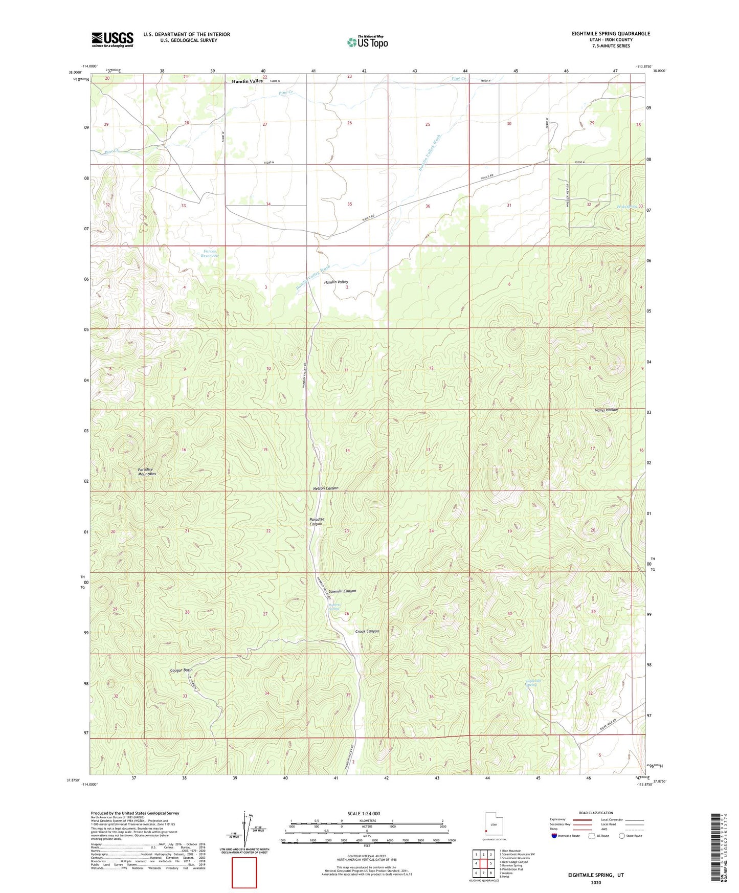
2023 topographic map quadrangle Eightmile Spring in the state of Utah. Scale: 1:24000. Based on the newly updated USGS 7.5' US Topo map series, this map is in the following counties: Iron. The map contains contour data, water features, and other items you are used to seeing on USGS maps, but also has updated roads and other features. This is the next generation of topographic maps. Printed on high-quality waterproof paper with UV fade-resistant inks.
Quads adjacent to this one:
West: Deer Lodge Canyon
Northwest: Rice Mountain
North: Steamboat Mountain SW
Northeast: Steamboat Mountain
East: Bannion Spring
Southeast: Heist
South: Modena
Southwest: Prohibition Flat
This map covers the same area as the classic USGS quad with code o37113h8.
Contains the following named places: CCC Camp, Cougar Basin, Crook Canyon, Eightmile Spring, Forces Reservoir, Hamlin Valley, Nelson Canyon, Paradise Canyon, Peaks Spring, Roberts Spring, Sawmill Canyon