MyTopo
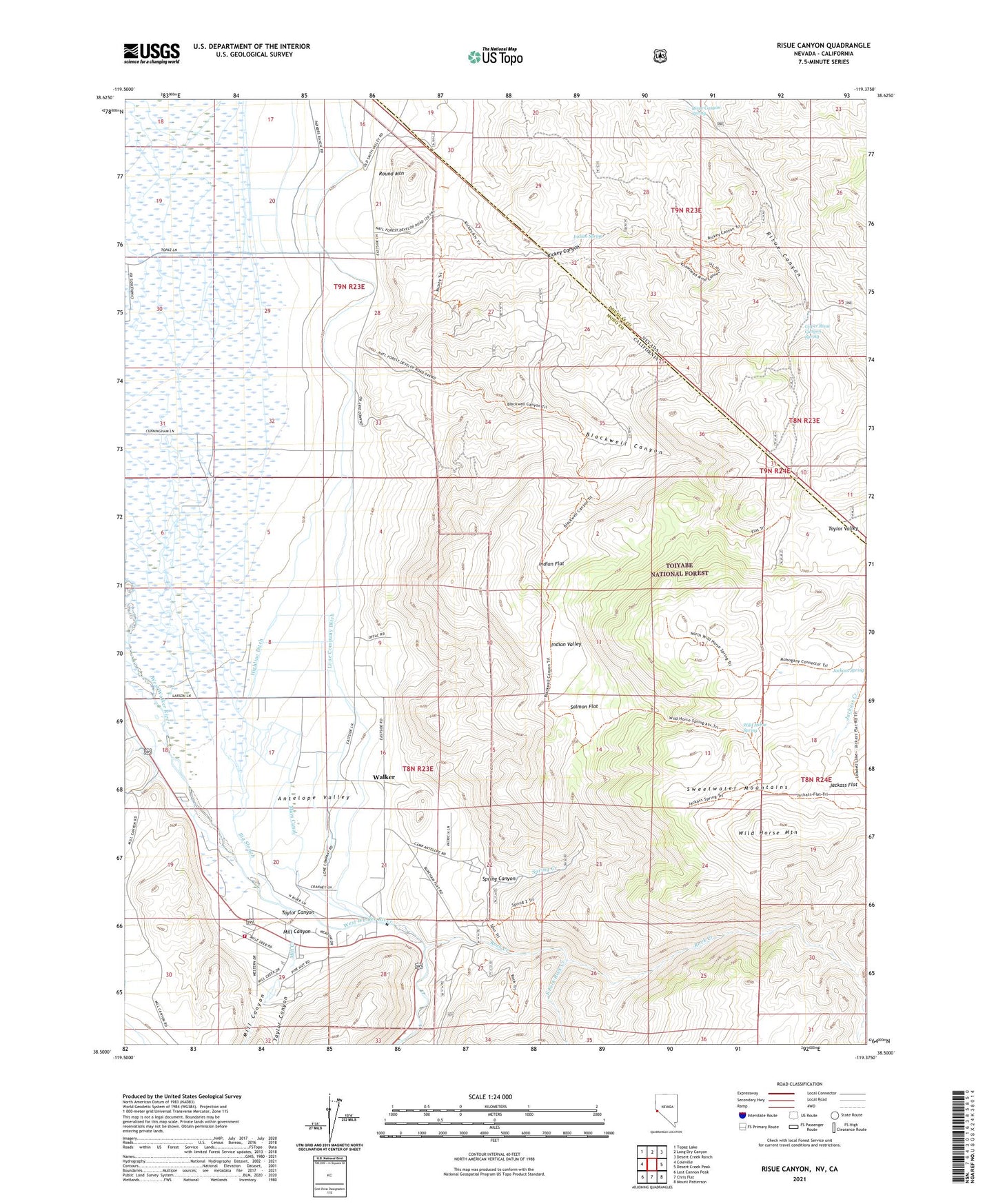
Risue Canyon Nevada US Topo Map
Couldn't load pickup availability
Also explore the Risue Canyon Forest Service Topo of this same quad for updated USFS data
2021 topographic map quadrangle Risue Canyon in the states of California, Nevada. Scale: 1:24000. Based on the newly updated USGS 7.5' US Topo map series, this map is in the following counties: Douglas, Mono. The map contains contour data, water features, and other items you are used to seeing on USGS maps, but also has updated roads and other features. This is the next generation of topographic maps. Printed on high-quality waterproof paper with UV fade-resistant inks.
Quads adjacent to this one:
West: Coleville
Northwest: Topaz Lake
North: Long Dry Canyon
Northeast: Desert Creek Ranch
East: Desert Creek Peak
Southeast: Mount Patterson
South: Chris Flat
Southwest: Lost Cannon Peak
This map covers the same area as the classic USGS quad with code o38119e4.
Contains the following named places: Antelope Valley Volunteer Fire Department, Arrowhead Mine, Big Slough, Blackwell Canyon, Camp Antelope, Highline Ditch, Indian Flat, Indian Spring, Indian Valley, Lilly Mine, Lone Company Ditch, Main Canal, Mill Canyon, Mill Creek, Mono County Paramedics Station 1, Rickey Canyon, Risue Canyon Spring, Risue Mining District, Rock Creek, Round Mountain, Salmon Flat, South Fork Rock Creek, Spring Canyon, Spring Creek, Taylor Canyon, Taylor Valley, Upper Risue Canyon Spring, Walker, Walker Census Designated Place, Wild Horse Mountain, Wild Horse Spring