MyTopo
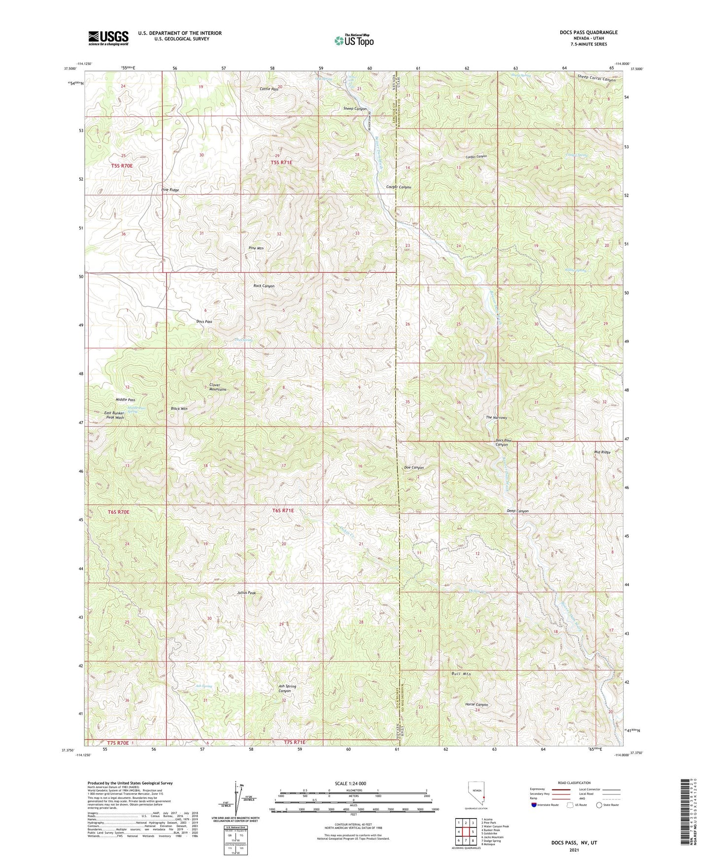
Docs Pass Nevada US Topo Map
Couldn't load pickup availability
2021 topographic map quadrangle Docs Pass in the states of Nevada, Utah. Scale: 1:24000. Based on the newly updated USGS 7.5' US Topo map series, this map is in the following counties: Lincoln, Washington. The map contains contour data, water features, and other items you are used to seeing on USGS maps, but also has updated roads and other features. This is the next generation of topographic maps. Printed on high-quality waterproof paper with UV fade-resistant inks.
Quads adjacent to this one:
West: Bunker Peak
Northwest: Acoma
North: Pine Park
Northeast: Water Canyon Peak
East: Goldstrike
Southeast: Motoqua
South: Dodge Spring
Southwest: Jacks Mountain
Contains the following named places: Ash Spring, Ash Spring Canyon, Ash Spring Exclosure, Black Mountain, Bull Mountain, Cattle Pass, Cougar Canyon, Cougar Canyon Wilderness, Cougar Spring, Deep Canyon, Dobin Creek, Docs Pass, Docs Pass Canyon, Doc's Pass Wilderness, Docs Spring, Doe Canyon, Holts Cabin, Julius Peak, Middle Pass, Middle Pass Spring, Middle Ridge, Middle Ridge Exclosure, Oak Spring, Pine Mountain, Pine Ridge, Sheep Canyon, Slaughter Creek, The Narrows, Water and Ice Falls, Willow Spring