MyTopo
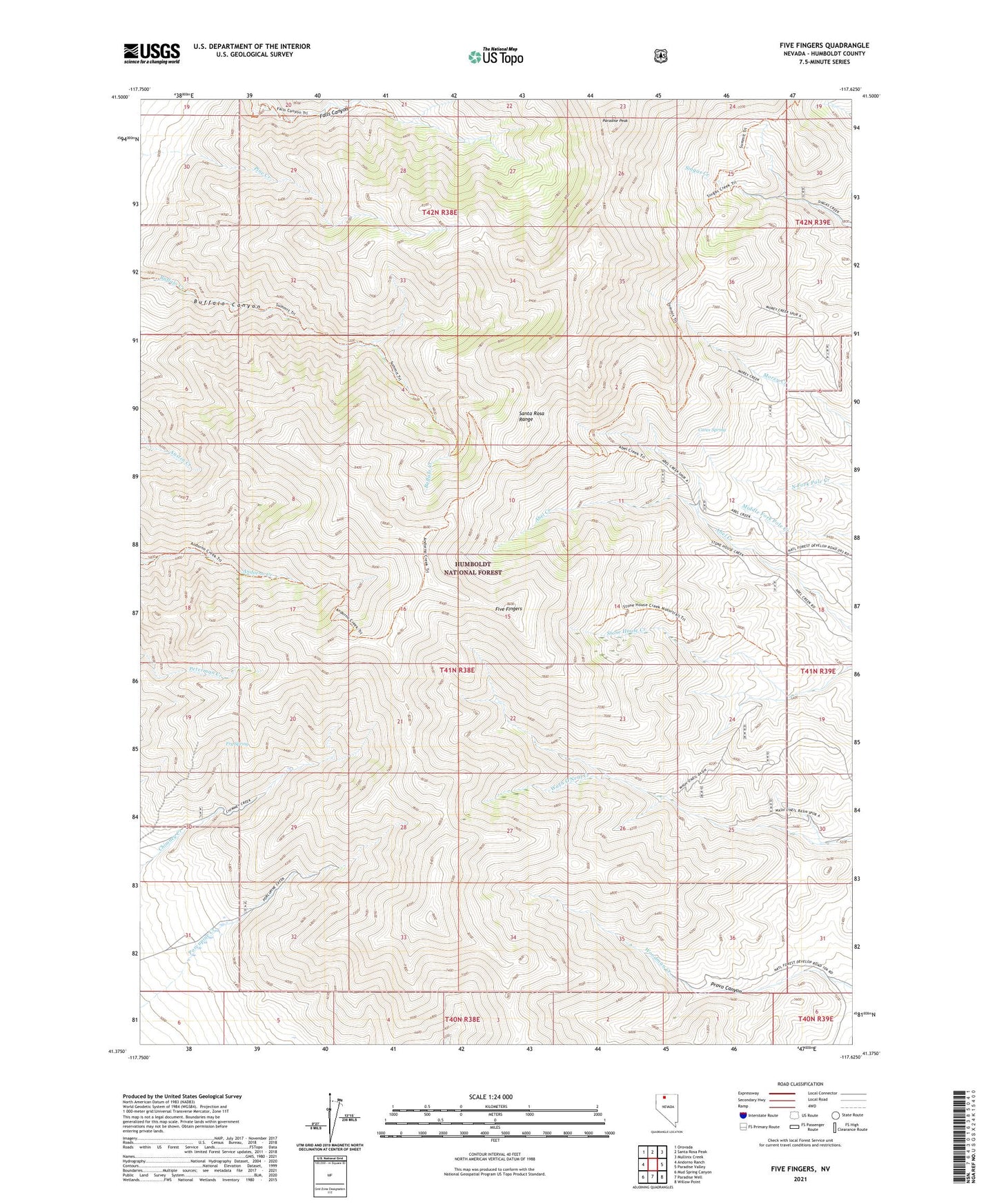
Five Fingers Nevada US Topo Map
Couldn't load pickup availability
Also explore the Five Fingers Forest Service Topo of this same quad for updated USFS data
2021 topographic map quadrangle Five Fingers in the state of Nevada. Scale: 1:24000. Based on the newly updated USGS 7.5' US Topo map series, this map is in the following counties: Humboldt. The map contains contour data, water features, and other items you are used to seeing on USGS maps, but also has updated roads and other features. This is the next generation of topographic maps. Printed on high-quality waterproof paper with UV fade-resistant inks.
Quads adjacent to this one:
West: Andorno Ranch
Northwest: Orovada
North: Santa Rosa Peak
Northeast: Mullinix Creek
East: Paradise Valley
Southeast: Willow Point
South: Paradise Well
Southwest: Mud Spring Canyon
This map covers the same area as the classic USGS quad with code o41117d6.
Contains the following named places: Carex Spring, Charleston Hill Mine, Eclipse Mine, Five Fingers, Fry Spring, Paradise Peak, Santa Rosa Range, Shon Mining District, Singas Creek Recreational Site, Summit Trail