MyTopo
Paradise Valley Nevada US Topo Map
Couldn't load pickup availability
Also explore the Paradise Valley Forest Service Topo of this same quad for updated USFS data
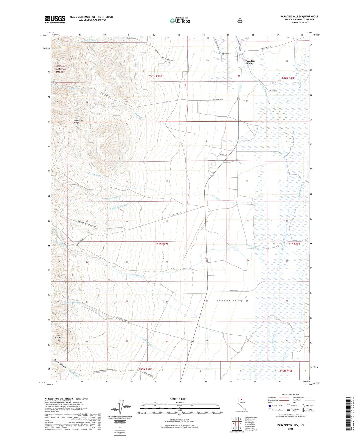
2021 topographic map quadrangle Paradise Valley in the state of Nevada. Scale: 1:24000. Based on the newly updated USGS 7.5' US Topo map series, this map is in the following counties: Humboldt. The map contains contour data, water features, and other items you are used to seeing on USGS maps, but also has updated roads and other features. This is the next generation of topographic maps. Printed on high-quality waterproof paper with UV fade-resistant inks.
Quads adjacent to this one:
West: Five Fingers
Northwest: Santa Rosa Peak
North: Mullinix Creek
Northeast: Spring City
East: Little Poverty
Southeast: Hot Springs Peak
South: Willow Point
Southwest: Paradise Well
This map covers the same area as the classic USGS quad with code o41117d5.
Contains the following named places: Abel Creek, Adams Slough, Archibald Ranch, Boggio Ranch, Burge Ranch, Casinelli Ranch, Ferraro Ranch, Gavica Ranch, Marie Miller Ranch, McCleary Reed Ranch, Middle Fork Pole Creek, Miller Ranch, Morey Creek, North Fork Hanson Creek, North Fork Pole Creek, Old Colony Ranch, Paradise Valley, Paradise Valley Administrative Site, Paradise Valley Census Designated Place, Paradise Valley Elementary School, Paradise Valley Fire Protection District, Paradise Valley Post Office, Paradise Valley Ranger Station, Provo Canyon, Read Ranch, Singas Creek, South Fork Hanson Creek, Stone House, Stone House Creek, Trap Butte