MyTopo
Gabbs Mountain Nevada US Topo Map
Couldn't load pickup availability
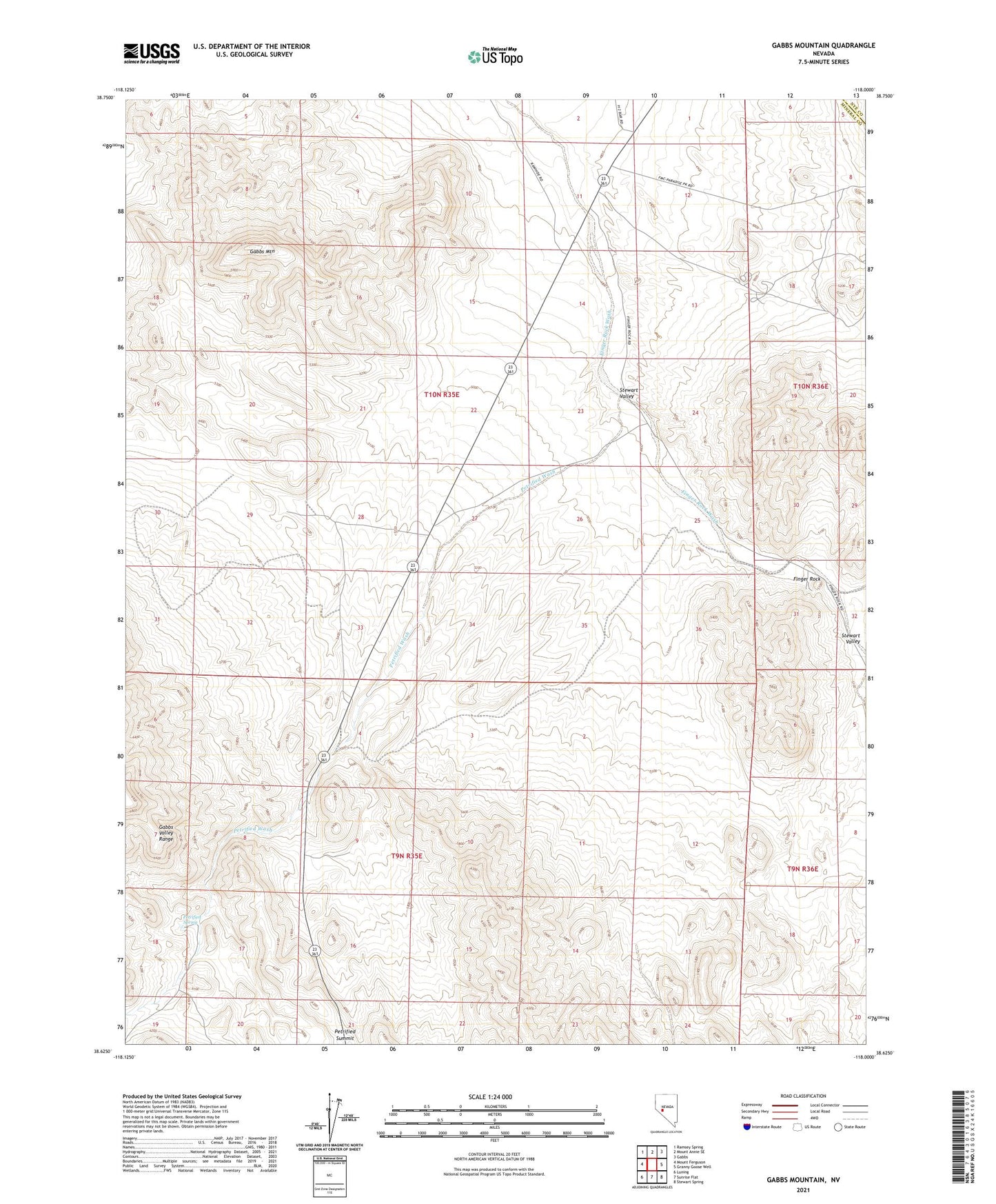
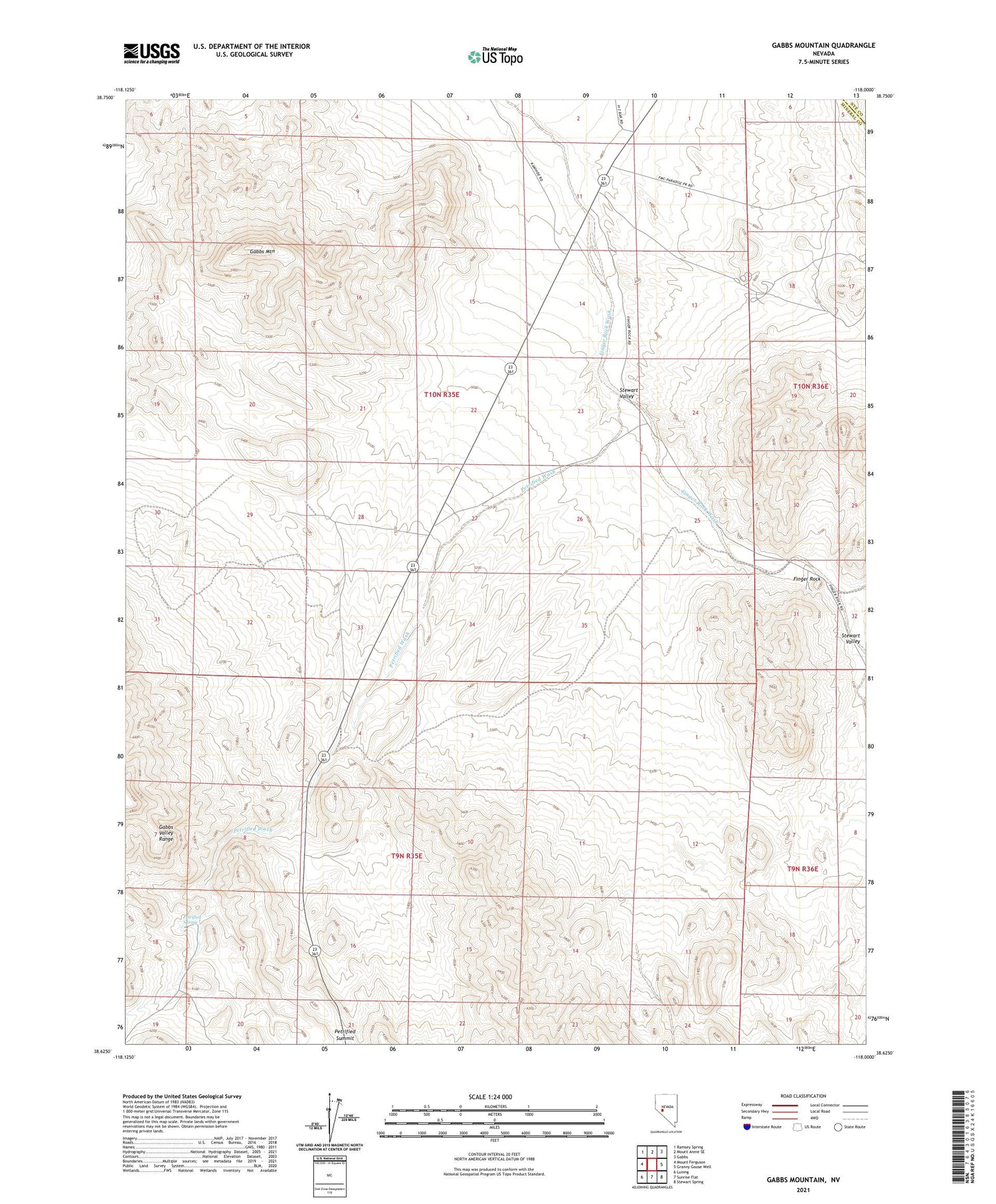
2021 topographic map quadrangle Gabbs Mountain in the state of Nevada. Scale: 1:24000. Based on the newly updated USGS 7.5' US Topo map series, this map is in the following counties: Mineral, Nye. The map contains contour data, water features, and other items you are used to seeing on USGS maps, but also has updated roads and other features. This is the next generation of topographic maps. Printed on high-quality waterproof paper with UV fade-resistant inks.
Quads adjacent to this one:
West: Mount Ferguson
Northwest: Ramsey Spring
North: Mount Annie SE
Northeast: Gabbs
East: Granny Goose Well
Southeast: Stewart Spring
South: Sunrise Flat
Southwest: Luning
Contains the following named places: Antone Wash, Finger Rock, Finger Rock Well Number Three, Gabbs Mountain, Petrified Spring, Petrified Summit, Petrified Wash, Stewart Valley, Stinson Well