MyTopo
Gold Butte Nevada US Topo Map
Couldn't load pickup availability
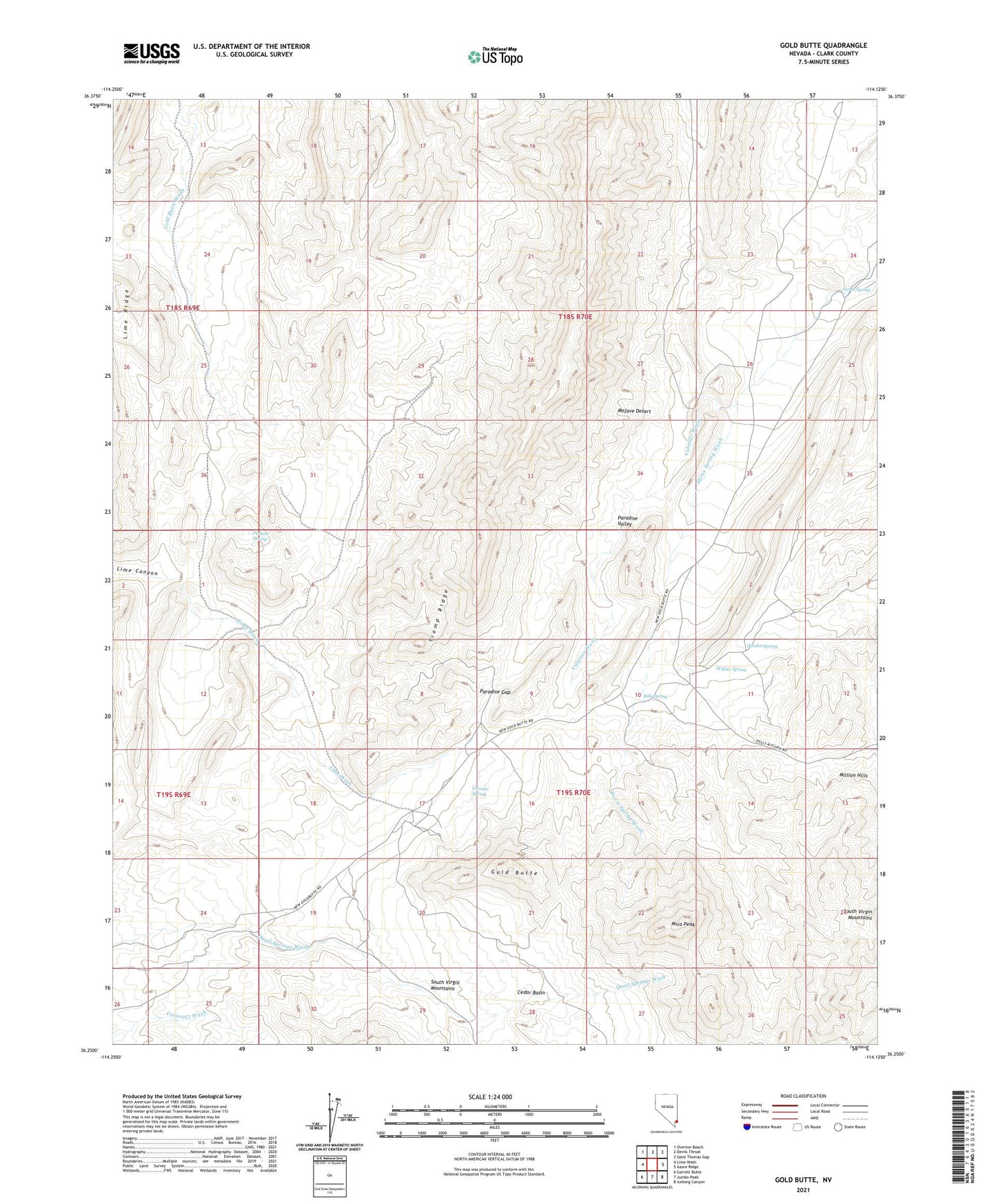
2021 topographic map quadrangle Gold Butte in the state of Nevada. Scale: 1:24000. Based on the newly updated USGS 7.5' US Topo map series, this map is in the following counties: Clark. The map contains contour data, water features, and other items you are used to seeing on USGS maps, but also has updated roads and other features. This is the next generation of topographic maps. Printed on high-quality waterproof paper with UV fade-resistant inks.
Quads adjacent to this one:
West: Lime Wash
Northwest: Overton Beach
North: Devils Throat
Northeast: Saint Thomas Gap
East: Azure Ridge
Southeast: Iceberg Canyon
South: Jumbo Peak
Southwest: Garrett Butte
This map covers the same area as the classic USGS quad with code o36114c2.
Contains the following named places: Azure Ridge Mine, Baylor, Bills Spring, Black Jack Mine, Copper City, Garden Spring, Gold Butte, Gold Butte Mine, Gold Butte Mining District, Gold Butte Post Office, Granite Spring, Hill Top Mine, Horse Spring, Indian Trail Wash, Lincoln Mine, Mica Peak, Million Hills, Ole Mine, Paradise Gap, Paradise Valley, Perkins Spring, Snowflake Mine, South Virgin Mountains, Summit Pass, Summit Spring, Tramp Ridge, Valatier Wash, Vermiculite Mine, Voight Well, Willow Spring