MyTopo
Lime Wash Nevada US Topo Map
Couldn't load pickup availability
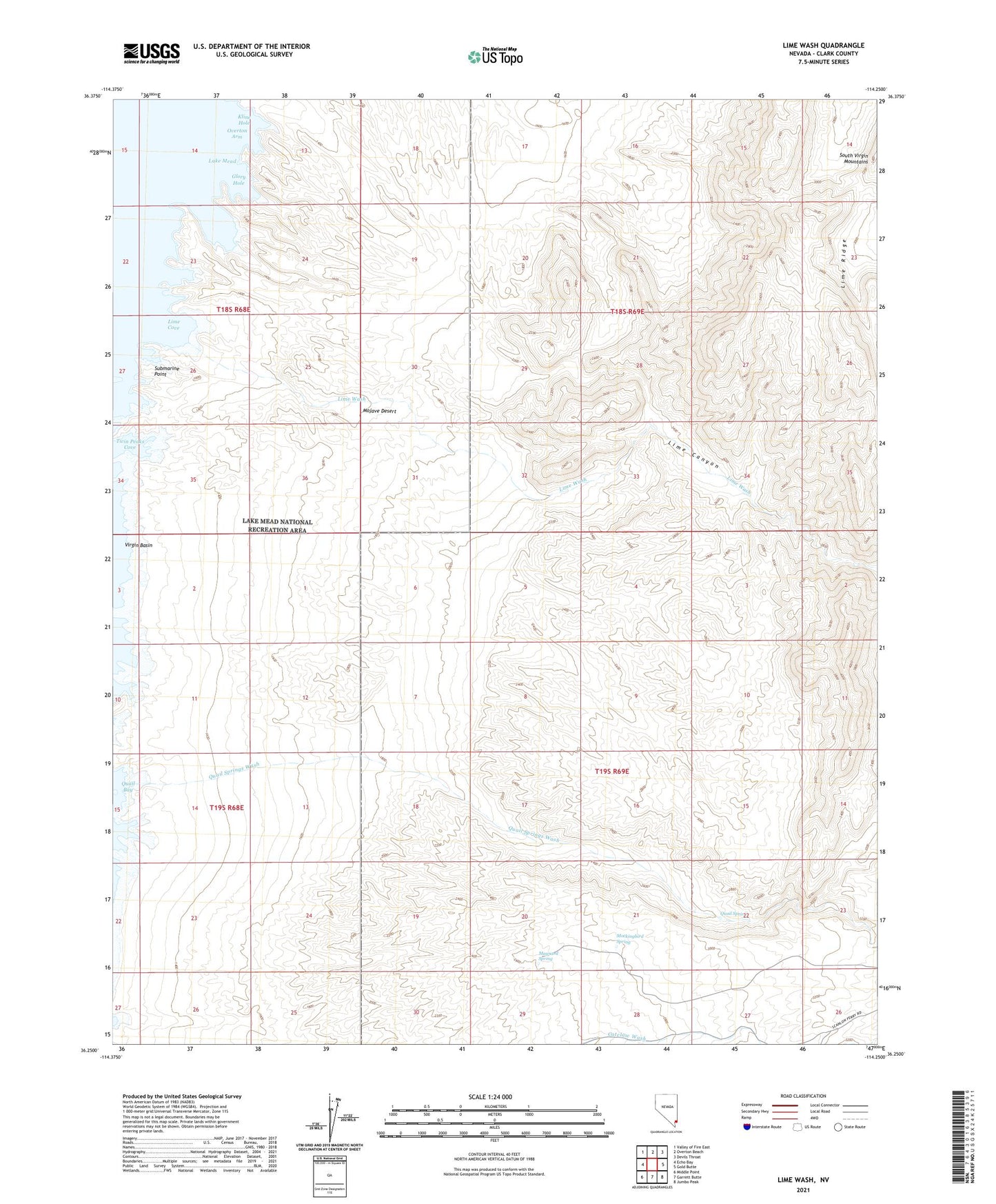
2021 topographic map quadrangle Lime Wash in the state of Nevada. Scale: 1:24000. Based on the newly updated USGS 7.5' US Topo map series, this map is in the following counties: Clark. The map contains contour data, water features, and other items you are used to seeing on USGS maps, but also has updated roads and other features. This is the next generation of topographic maps. Printed on high-quality waterproof paper with UV fade-resistant inks.
Quads adjacent to this one:
West: Echo Bay
Northwest: Valley of Fire East
North: Overton Beach
Northeast: Devils Throat
East: Gold Butte
Southeast: Jumbo Peak
South: Garrett Butte
Southwest: Middle Point
This map covers the same area as the classic USGS quad with code o36114c3.
Contains the following named places: Cottonwood Cove, Glory Hole, Kline Hole, Lime Canyon, Lime Canyon Wilderness, Lime Cove, Lime Ridge, Lime Wash, Maynard Spring, Mockingbird Spring, Preachers Cove, Quail Bay, Quail Spring, Quail Springs Wash, Submarine Point, Twin Peaks Cove, Weasel Hole, Whale Rock