MyTopo
McDermid Ranch Nevada US Topo Map
Couldn't load pickup availability
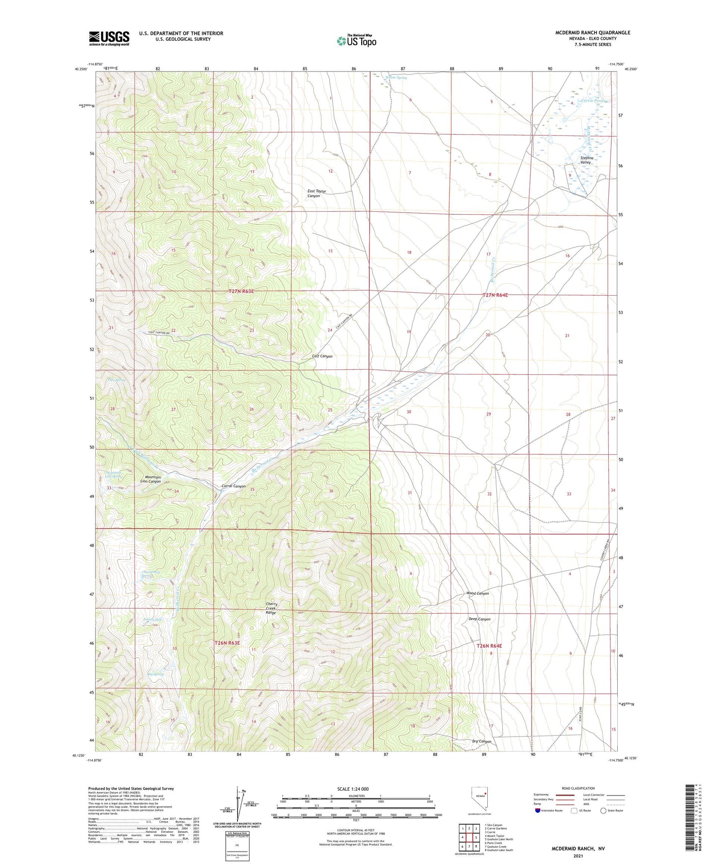
2021 topographic map quadrangle McDermid Ranch in the state of Nevada. Scale: 1:24000. Based on the newly updated USGS 7.5' US Topo map series, this map is in the following counties: Elko. The map contains contour data, water features, and other items you are used to seeing on USGS maps, but also has updated roads and other features. This is the next generation of topographic maps. Printed on high-quality waterproof paper with UV fade-resistant inks.
Quads adjacent to this one:
West: Mount Taylor
Northwest: Silo Canyon
North: Currie Gardens
Northeast: Currie
East: Goshute Lake North
Southeast: Goshute Lake South
South: Goshute Creek
Southwest: Paris Creek
This map covers the same area as the classic USGS quad with code o40114b7.
Contains the following named places: Big Spring, Calf Canyon, Cheat Grass Spring, Corral Canyon, Currie Ponds, Deep Canyon, Dry Canyon, East Taylor Canyon, Julians Hole, McDermid Ranch, Mountain Lion Canyon, Mountain Lion Spring, North Fork Williams Creek, Phalen Well, Pipe Spring, Quaker Spring, Willow Spring, Wood Canyon