MyTopo
Hoover Dam Nevada US Topo Map
Couldn't load pickup availability
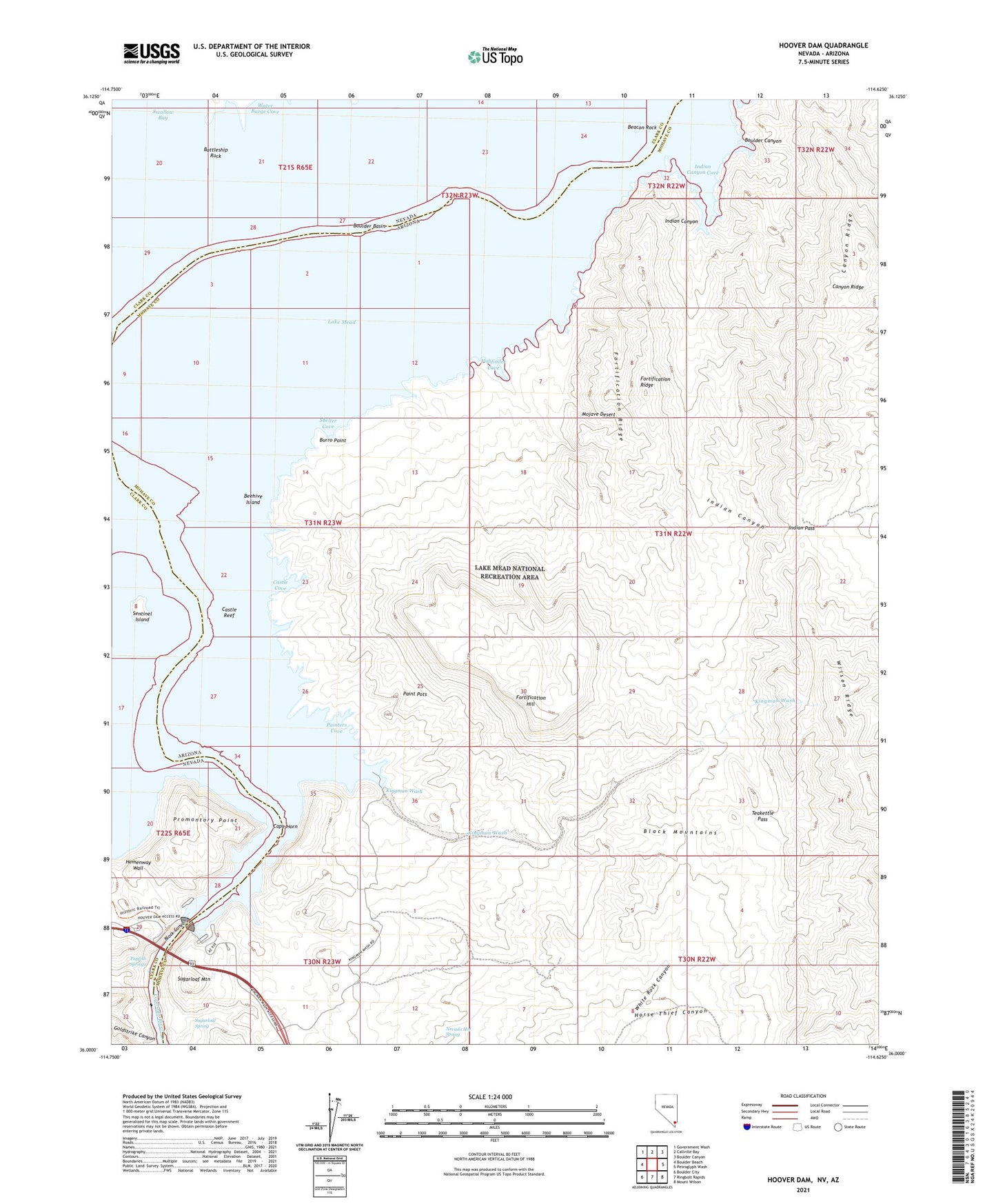
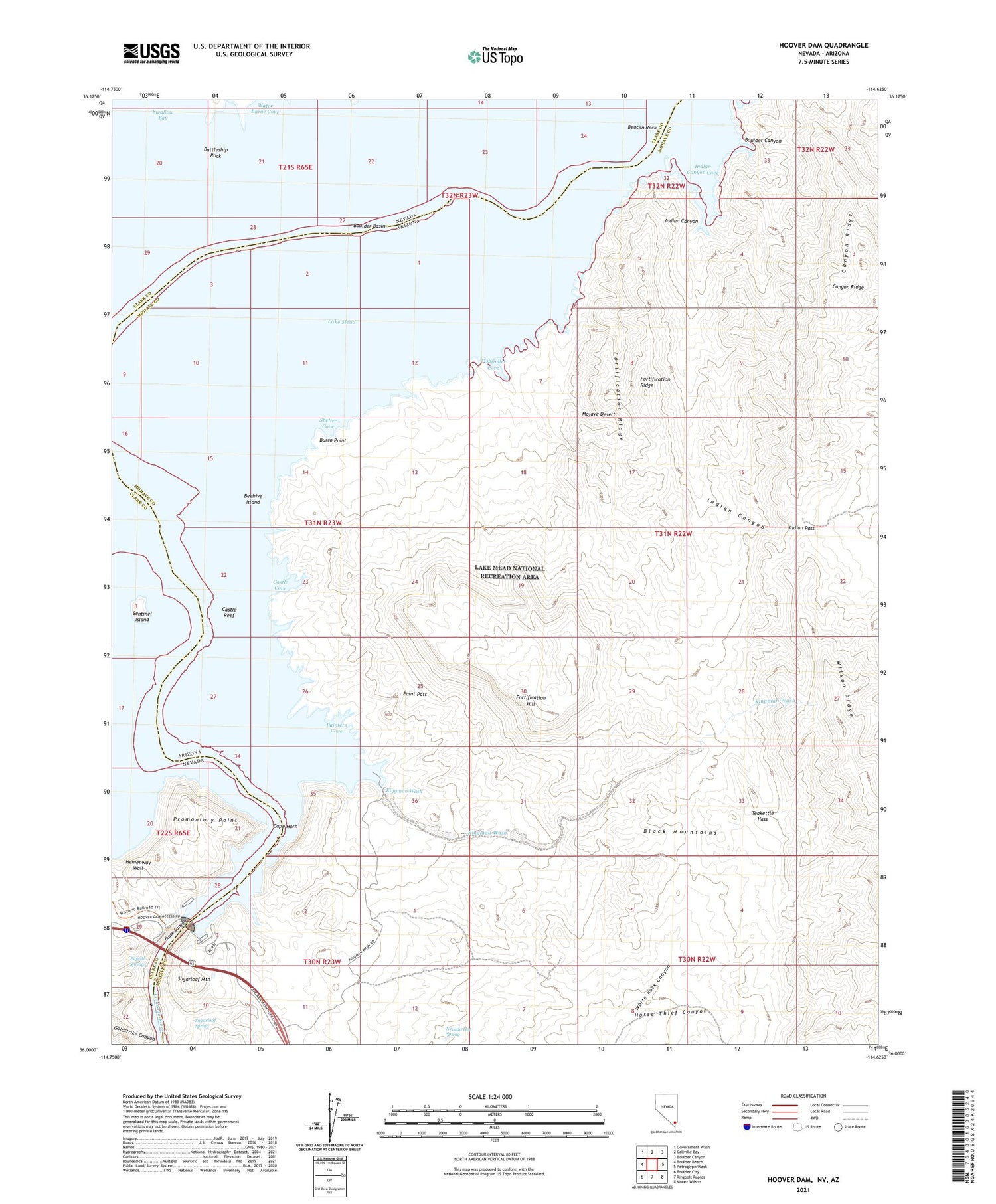
2021 topographic map quadrangle Hoover Dam in the states of Arizona, Nevada. Scale: 1:24000. Based on the newly updated USGS 7.5' US Topo map series, this map is in the following counties: Clark, Mohave. The map contains contour data, water features, and other items you are used to seeing on USGS maps, but also has updated roads and other features. This is the next generation of topographic maps. Printed on high-quality waterproof paper with UV fade-resistant inks.
Quads adjacent to this one:
West: Boulder Beach
Northwest: Government Wash
North: Callville Bay
Northeast: Boulder Canyon
East: Petroglyph Wash
Southeast: Mount Wilson
South: Ringbolt Rapids
Southwest: Boulder City
Contains the following named places: Battleship Rock, Beacon Rock, Beehive Island, Burro Point, Callville Dam Site, Callville Post Office, Canyon Ridge, Cape Horn, Cashman Landing, Castle Cove, Castle Reef, Fishfinder Cove, Fort Callville, Fortification Hill, Fortification Ridge, Goldstrike Canyon, Hemenway Wall, Hesse Camp, Himix, Hoover Dam, Horse Thief Canyon, Indian Canyon, Indian Canyon Cove, Indian Pass, Jamestown, Kingman Wash, Lomix Plant, Lookout Point, Nevada Hot Spring, Old Pope Mine, Paint Pots, Painters Cove, Promontory Point, Pupfish Springs, Sentinel Island, Shelter Cove, Sugarloaf Mountain, Sugarloaf Spring, Teakettle Pass, Upper Black Canyon Dam Site, US Bureau of Reclamation Hoover Dam Water Treatment Plant, Weather Raft