MyTopo
Boulder Canyon Nevada US Topo Map
Couldn't load pickup availability
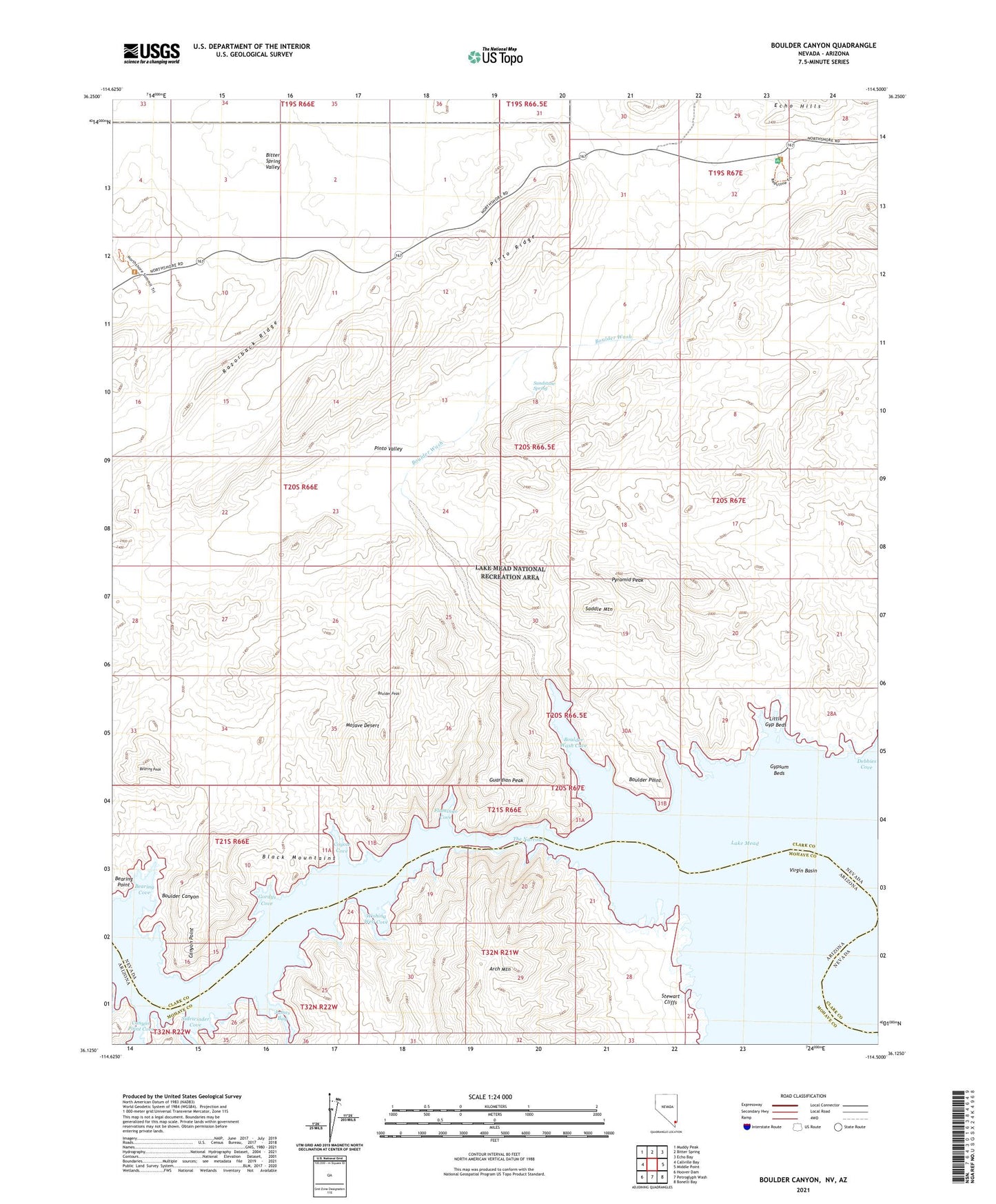
2021 topographic map quadrangle Boulder Canyon in the states of Nevada, Arizona. Scale: 1:24000. Based on the newly updated USGS 7.5' US Topo map series, this map is in the following counties: Clark, Mohave. The map contains contour data, water features, and other items you are used to seeing on USGS maps, but also has updated roads and other features. This is the next generation of topographic maps. Printed on high-quality waterproof paper with UV fade-resistant inks.
Quads adjacent to this one:
West: Callville Bay
Northwest: Muddy Peak
North: Bitter Spring
Northeast: Echo Bay
East: Middle Point
Southeast: Bonelli Bay
South: Petroglyph Wash
Southwest: Hoover Dam
This map covers the same area as the classic USGS quad with code o36114b5.
Contains the following named places: Arch Mountain, Bearing Cove, Bearing Peak, Bearing Point, Bitter Spring Valley, Boulder Canyon Dam Site, Boulder Peak, Boulder Point, Boulder Rapids, Boulder Wash, Boulder Wash Cove, Canyon Point, Canyon Point Cove, Coyote Cove, East End Light, Flamingo Cove, Gordys Cove, Guardian Peak, Gypsum Beds, James Bay, Little Gyp Beds, Pinto Ridge, Pinto Valley, Pinto Valley Wilderness, Pyramid Peak, Razorback Ridge, Saddle Mountain, Sandstone Spring, Sidewinder Cove, Stewart Cliffs, The Narrows, Wishing Well Cove