MyTopo
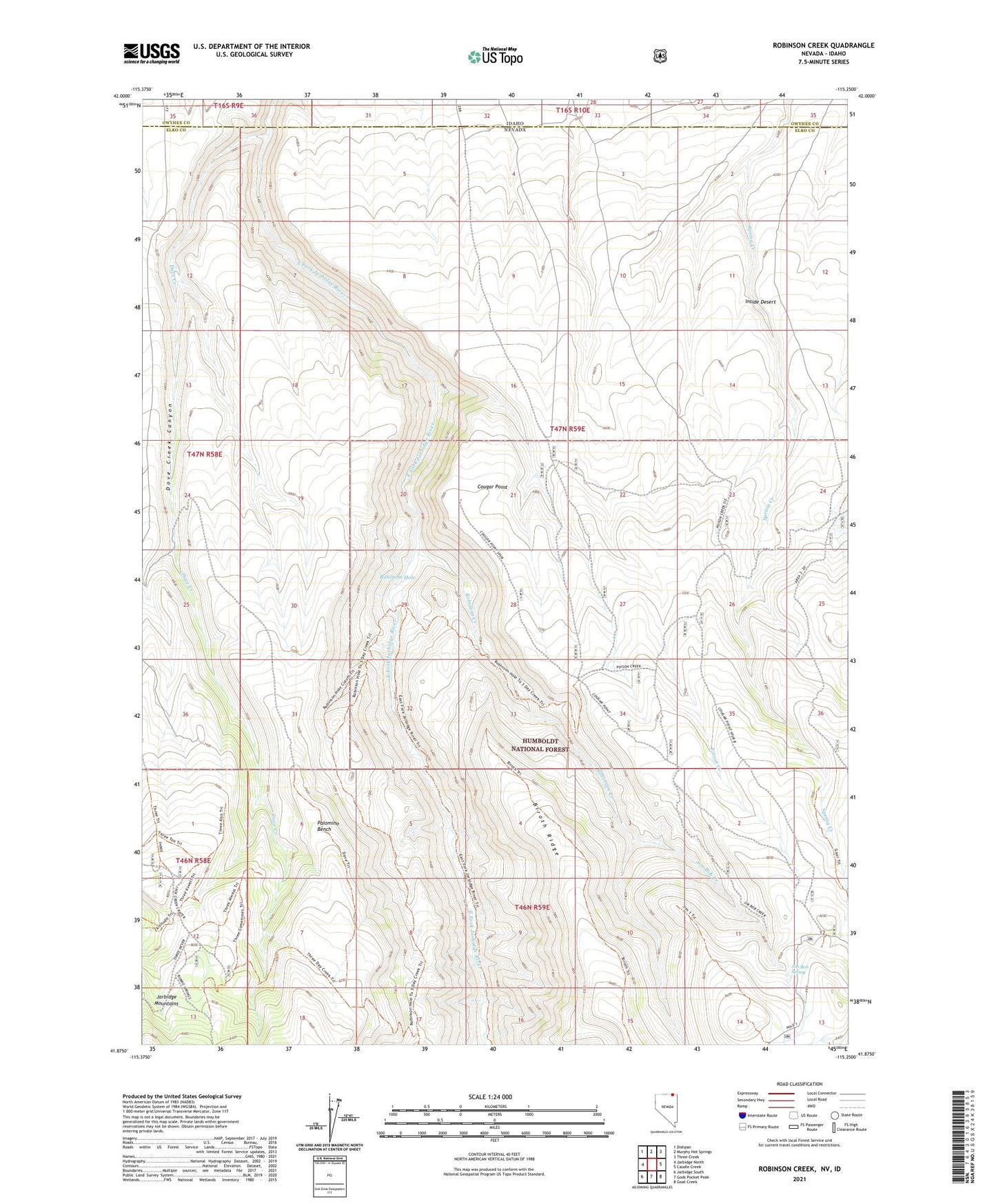
Robinson Creek Nevada US Topo Map
Couldn't load pickup availability
Also explore the Robinson Creek Forest Service Topo of this same quad for updated USFS data
2021 topographic map quadrangle Robinson Creek in the state of Nevada. Scale: 1:24000. Based on the newly updated USGS 7.5' US Topo map series, this map is in the following counties: Elko, Owyhee. The map contains contour data, water features, and other items you are used to seeing on USGS maps, but also has updated roads and other features. This is the next generation of topographic maps. Printed on high-quality waterproof paper with UV fade-resistant inks.
Quads adjacent to this one:
West: Jarbidge North
Northwest: Dishpan
North: Murphy Hot Springs
Northeast: Three Creek
East: Caudle Creek
Southeast: Goat Creek
South: Gods Pocket Peak
Southwest: Jarbidge South
This map covers the same area as the classic USGS quad with code o41115h3.
Contains the following named places: Cougar Point, Dave Creek, Dove Creek Canyon, Empire Mine, Gaar Place, Howard Cabin, Inside Desert, Jack Creek Tank, Jim Bob Creek, Jim Bob Spring, Little Island, Palomino Bench, Red Blowout Mine, Robinson Creek, Robinson Hole, Three Day Creek Trailhead