MyTopo
Lahontan Dam Nevada US Topo Map
Couldn't load pickup availability
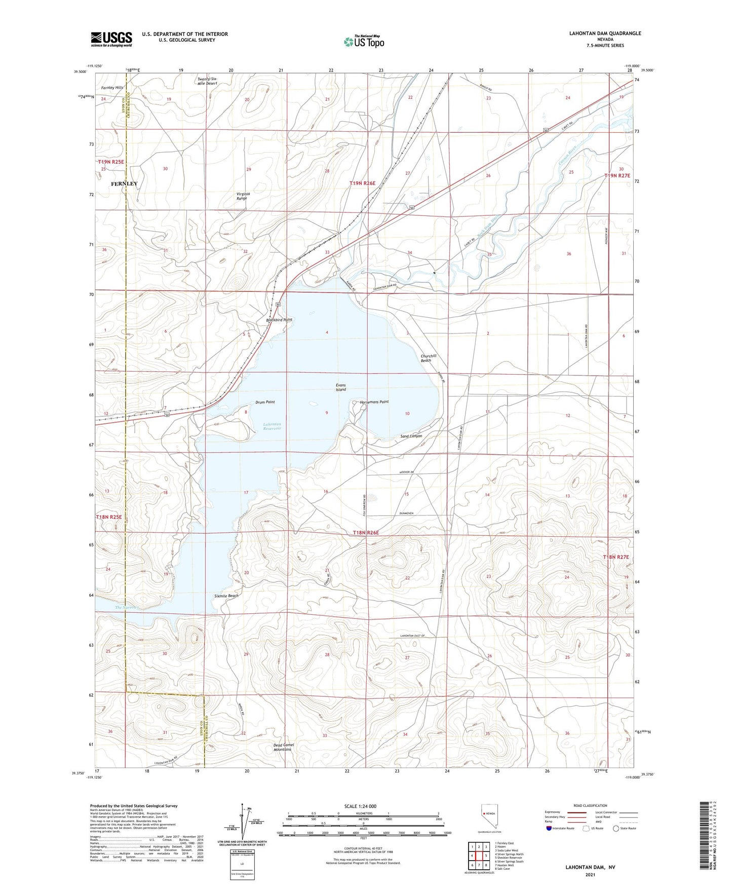
2021 topographic map quadrangle Lahontan Dam in the state of Nevada. Scale: 1:24000. Based on the newly updated USGS 7.5' US Topo map series, this map is in the following counties: Churchill, Lyon. The map contains contour data, water features, and other items you are used to seeing on USGS maps, but also has updated roads and other features. This is the next generation of topographic maps. Printed on high-quality waterproof paper with UV fade-resistant inks.
Quads adjacent to this one:
West: Silver Springs North
Northwest: Fernley East
North: Hazen
Northeast: Soda Lake West
East: Sheckler Reservoir
Southeast: Salt Cave
South: Hooten Well
Southwest: Silver Springs South
This map covers the same area as the classic USGS quad with code o39119d1.
Contains the following named places: Bisbys Station, Blackbird Point, Churchill Beach, Cottonwood Station, Drum Point, Evans Island, Horsemans Point, Lahontan, Lahontan Boat Landing, Lahontan Dam, Lahontan Post Office, Lahontan State Game Refuge, Lamar, Northam, Northam Post Office, Reeds Station, Rock Dam Ditch, Rock Dam Ditch Number 1, Rugby, Sand Canyon, Sixmile Beach, Sky Lateral, The Narrows