MyTopo
Fernley East Nevada US Topo Map
Couldn't load pickup availability
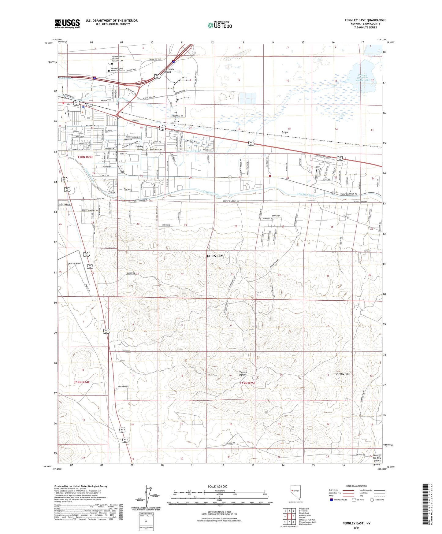
2021 topographic map quadrangle Fernley East in the state of Nevada. Scale: 1:24000. Based on the newly updated USGS 7.5' US Topo map series, this map is in the following counties: Lyon. The map contains contour data, water features, and other items you are used to seeing on USGS maps, but also has updated roads and other features. This is the next generation of topographic maps. Printed on high-quality waterproof paper with UV fade-resistant inks.
Quads adjacent to this one:
West: Fernley West
Northwest: Wadsworth
North: Two Tips
Northeast: Eagle Rock
East: Hazen
Southeast: Lahontan Dam
South: Silver Springs North
Southwest: Stockton Flat Well
This map covers the same area as the classic USGS quad with code o39119e2.
Contains the following named places: A Drain, Argo, City of Fernley, Cottonwood Elementary School, Fernley Dam Number One, Fernley Dam Number Three, Fernley Division, Fernley Drain, Fernley Elementary School, Fernley High School, Fernley Hills, Fernley Intermediate School, Fernley Out-of-Town Park, Fernley Post Office, Fernley Reservoir Number One, Fernley Reservoir Number Three, Fernley Well, K2B Canal, Luva, Lyon County Complex, Lyon County Sheriff's Office - Fernley Substation, North Lyon County Fire Protection District - Station 61, North Lyon County Fire Protection District - Station 62, Northern Nevada Veterans Memorial Cemetery, Renown Medical Group Urgent Care Center, Sage Flat Well, Streiff Drain, Tiger Field, Truckee Canal, Virginia Range, ZIP Code: 89408