MyTopo
McDermitt Nevada US Topo Map
Couldn't load pickup availability
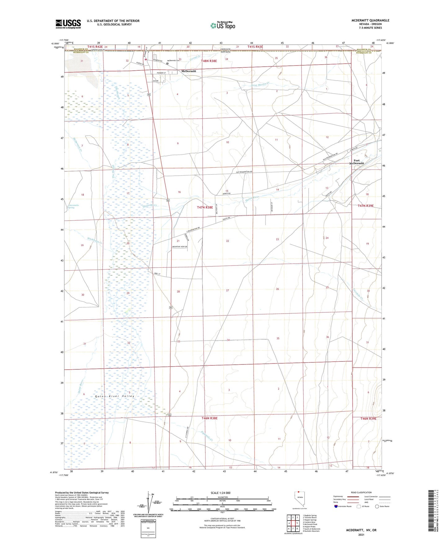
2021 topographic map quadrangle McDermitt in the states of Nevada, Oregon. Scale: 1:24000. Based on the newly updated USGS 7.5' US Topo map series, this map is in the following counties: Humboldt, Malheur. The map contains contour data, water features, and other items you are used to seeing on USGS maps, but also has updated roads and other features. This is the next generation of topographic maps. Printed on high-quality waterproof paper with UV fade-resistant inks.
Quads adjacent to this one:
West: Cordero Mine
Northwest: Boghole Spring
North: Tenmile Ranch
Northeast: Hoppin Springs
East: McConnell Peak
Southeast: Buckskin Mountain
South: South of McDermitt
Southwest: Hoppin Peaks
Contains the following named places: Corral Creek, Eightmile Creek, Fort McDermitt Census Designated Place, Fort McDermitt Indian Reservation, Fort McDermitt Ranch Headquarters, Giacometto Ranch, Giacometto Spring, Great Basin College McDermitt Satellite Center, Mc Dermitt Post Office, McDermitt, McDermitt Cemetery, McDermitt Census Designated Place, McDermitt Creek, McDermitt Elementary School, McDermitt Fire Protection District, McDermitt High School, McDermitt Post Office, Minor Ranch, Noques Nevada Well, Saint Martin Creek, The Slough, Twomile Creek, UC Ranch, Washburn Creek