MyTopo
Boghole Spring Oregon US Topo Map
Couldn't load pickup availability
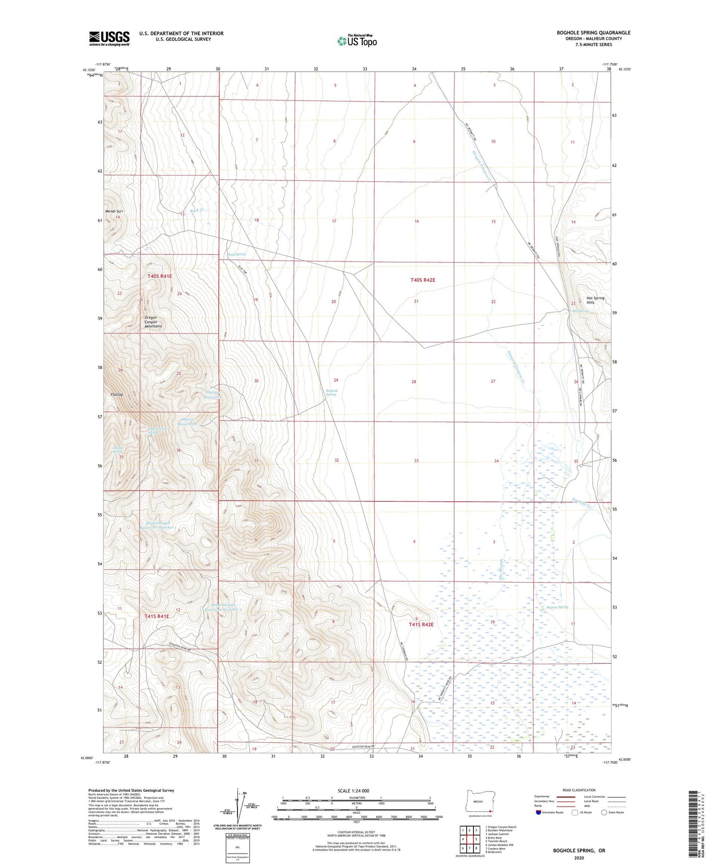
2023 topographic map quadrangle Boghole Spring in the state of Oregon. Scale: 1:24000. Based on the newly updated USGS 7.5' US Topo map series, this map is in the following counties: Malheur. The map contains contour data, water features, and other items you are used to seeing on USGS maps, but also has updated roads and other features. This is the next generation of topographic maps. Printed on high-quality waterproof paper with UV fade-resistant inks.
Quads adjacent to this one:
West: Bretz Mine
Northwest: Oregon Canyon Ranch
North: Bowden Waterhole
Northeast: Jackson Summit
East: Tenmile Ranch
Southeast: McDermitt
South: Cordero Mine
Southwest: Jordan Meadow NW
This map covers the same area as the classic USGS quad with code o42117a7.
Contains the following named places: Boghole Spring, Bryson Spring, Deafenbough Reservoir Number 1, Deafenbough Reservoir Number 2, Flattop Reservoir, Hot Spring, Hot Spring Hills, Jackson Creek, Juniper Spring, Little Queen Mine, McCormick Ranch, Mitchell Ranch, Myers Waterhole, Myers Well, Oregon Canyon Creek, Rock Creek, Seep Spring, State Section Spring, Vance Ranch, ZIP Code: 89421