MyTopo
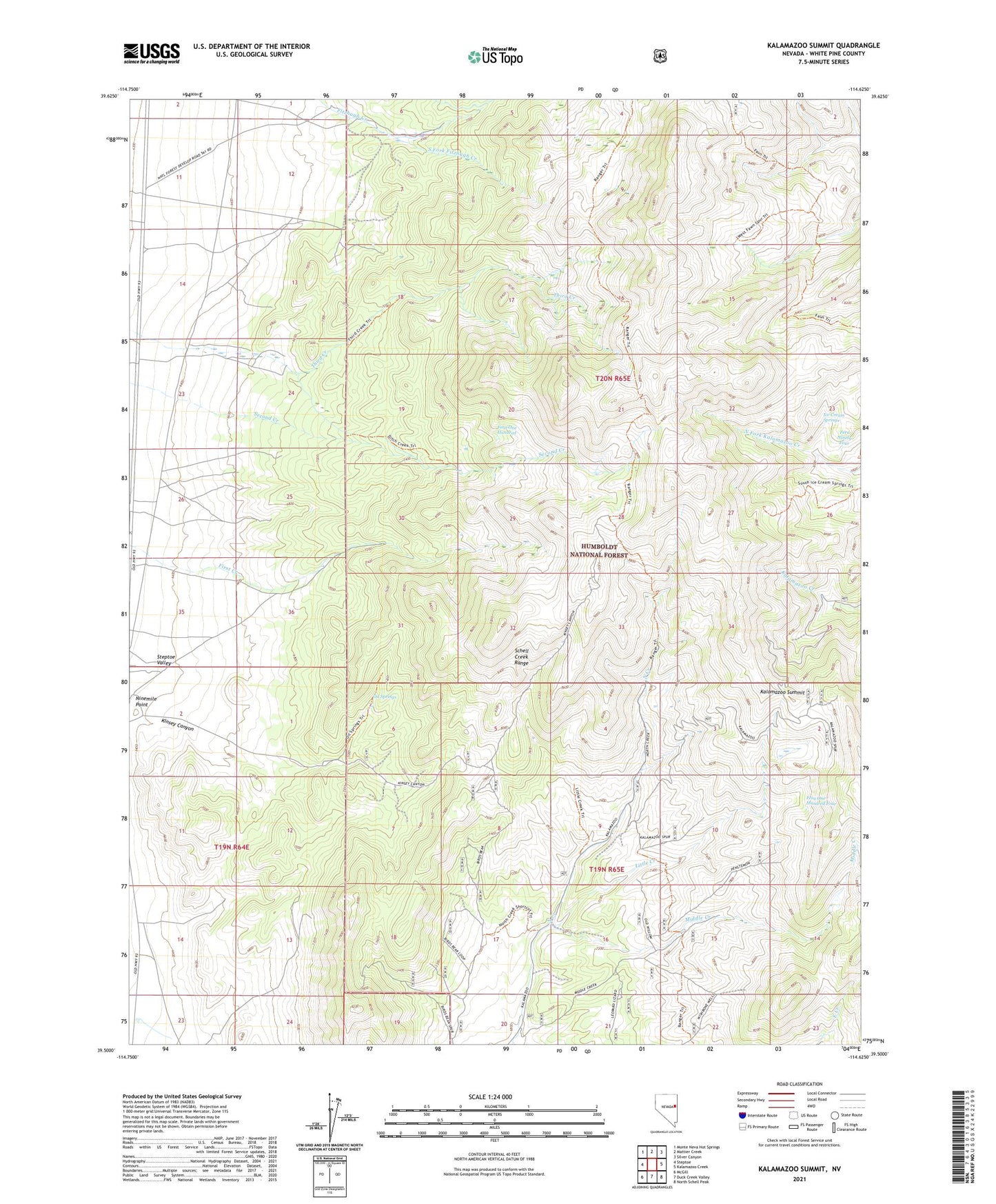
Kalamazoo Summit Nevada US Topo Map
Couldn't load pickup availability
Also explore the Kalamazoo Summit Forest Service Topo of this same quad for updated USFS data
2021 topographic map quadrangle Kalamazoo Summit in the state of Nevada. Scale: 1:24000. Based on the newly updated USGS 7.5' US Topo map series, this map is in the following counties: White Pine. The map contains contour data, water features, and other items you are used to seeing on USGS maps, but also has updated roads and other features. This is the next generation of topographic maps. Printed on high-quality waterproof paper with UV fade-resistant inks.
Quads adjacent to this one:
West: Steptoe
Northwest: Monte Neva Hot Springs
North: Mattier Creek
Northeast: Silver Canyon
East: Kalamazoo Creek
Southeast: North Schell Peak
South: Duck Creek Valley
Southwest: McGill
This map covers the same area as the classic USGS quad with code o39114e6.
Contains the following named places: Fera Ninety Four, Fera One Hundred, Fera One Hundred Four, Giles Place, Ice Cream Springs, Kalamazoo Summit, Kinsey Canyon, Little Creek, Middle Creek, Ninemile Point, Oil Springs, South Fork Fitzhugh Creek