MyTopo
Mineral Hill SW Nevada US Topo Map
Couldn't load pickup availability
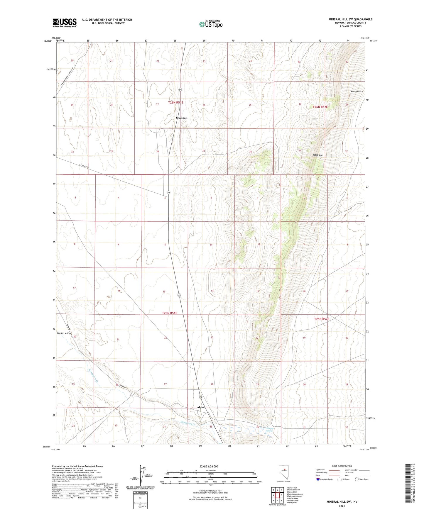
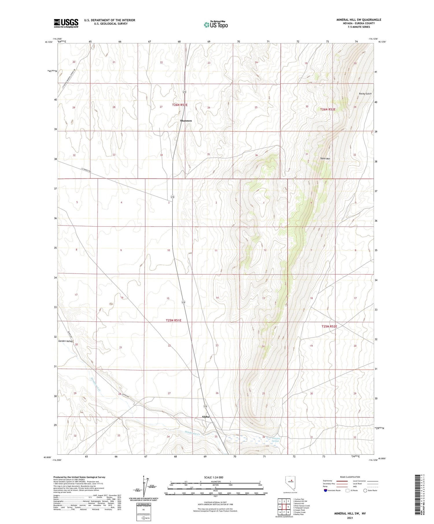
2021 topographic map quadrangle Mineral Hill SW in the state of Nevada. Scale: 1:24000. Based on the newly updated USGS 7.5' US Topo map series, this map is in the following counties: Eureka. The map contains contour data, water features, and other items you are used to seeing on USGS maps, but also has updated roads and other features. This is the next generation of topographic maps. Printed on high-quality waterproof paper with UV fade-resistant inks.
Quads adjacent to this one:
West: Pete Hanson Creek
Northwest: Curlow Flat
North: Mineral Hill NW
Northeast: Mineral Hill
East: Telegraph Canyon
Southeast: Bailey Pass
South: Frazier Creek
Southwest: Cooper Peak
Contains the following named places: Alpha, Alpha Post Office, Alpha Ranch, Chimney Springs, Chimney Station, Shannon, Table Mountain