MyTopo
Curlow Flat Nevada US Topo Map
Couldn't load pickup availability
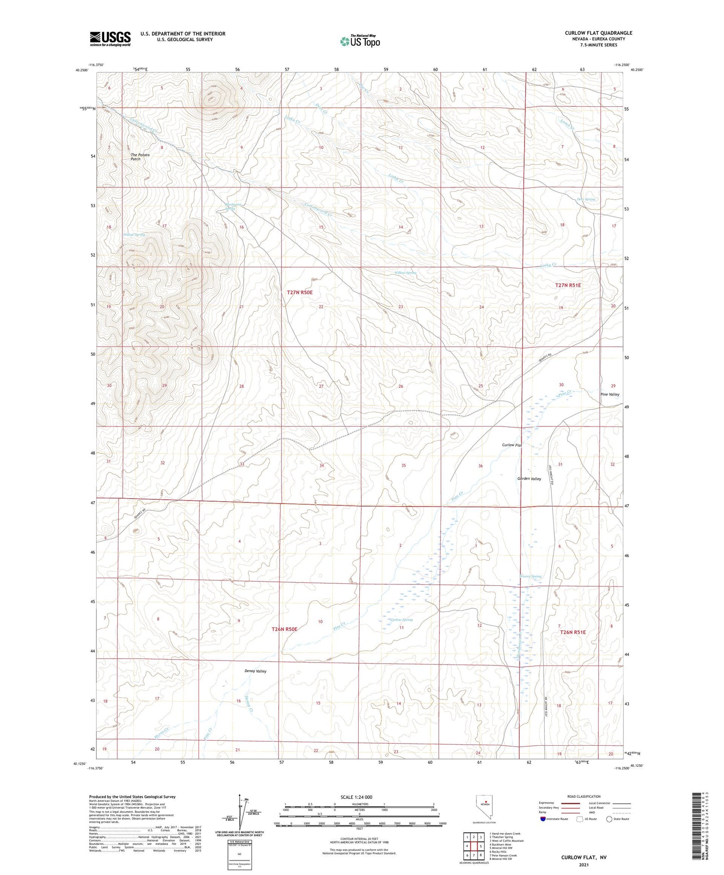
2021 topographic map quadrangle Curlow Flat in the state of Nevada. Scale: 1:24000. Based on the newly updated USGS 7.5' US Topo map series, this map is in the following counties: Eureka. The map contains contour data, water features, and other items you are used to seeing on USGS maps, but also has updated roads and other features. This is the next generation of topographic maps. Printed on high-quality waterproof paper with UV fade-resistant inks.
Quads adjacent to this one:
West: Buckhorn Mine
Northwest: Hand-me-down Creek
North: Thatcher Spring
Northeast: West of Coffin Mountain
East: Mineral Hill NW
Southeast: Mineral Hill SW
South: Pete Hanson Creek
Southwest: Rocky Hills
This map covers the same area as the classic USGS quad with code o40116b3.
Contains the following named places: Blackpoint Spring, Cottonwood Creek, Curlow Flat, Curlow Spring, Deer Spring, Denay Creek, Denay Valley, Doc Creek, Garden Valley, Henderson Creek, Horse Creek, Knight Ranch, Linka Creek, Moores Spring, The Potato Patch, Willow Spring