MyTopo
Nixon Nevada US Topo Map
Couldn't load pickup availability
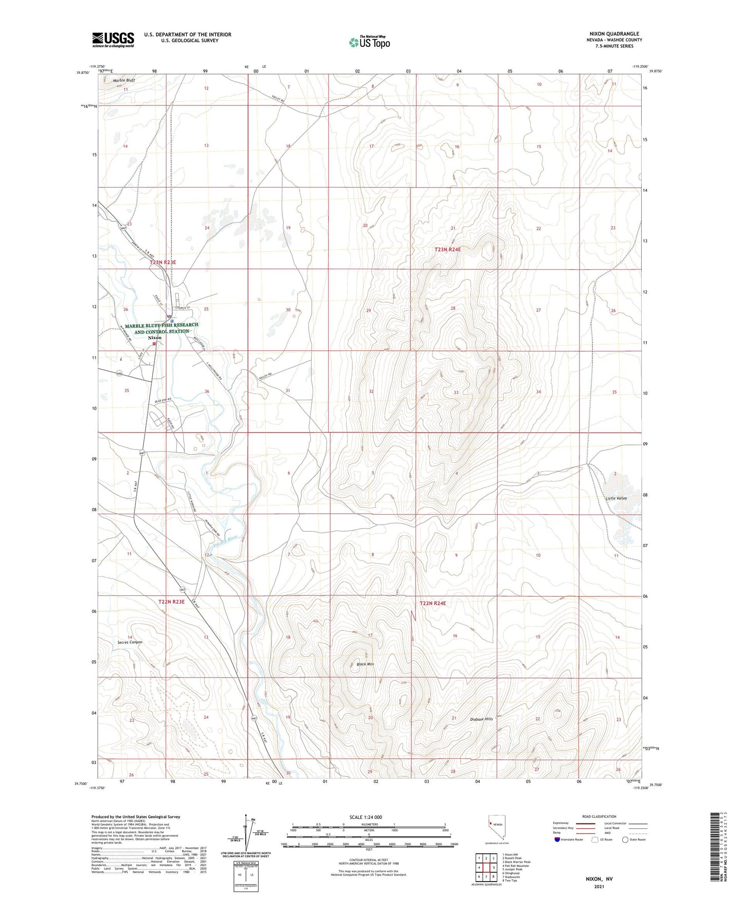
2021 topographic map quadrangle Nixon in the state of Nevada. Scale: 1:24000. Based on the newly updated USGS 7.5' US Topo map series, this map is in the following counties: Washoe. The map contains contour data, water features, and other items you are used to seeing on USGS maps, but also has updated roads and other features. This is the next generation of topographic maps. Printed on high-quality waterproof paper with UV fade-resistant inks.
Quads adjacent to this one:
West: Pah Rah Mountain
Northwest: Nixon NW
North: Russell Peak
Northeast: Black Warrior Peak
East: Juniper Peak
Southeast: Two Tips
South: Wadsworth
Southwest: Olinghouse
This map covers the same area as the classic USGS quad with code o39119g3.
Contains the following named places: Black Mountain, Little Valley, Nixon, Nixon Census Designated Place, Nixon Fire Department, Nixon Landing Strip, Nixon Post Office, Numana, Numana Dam, Piute Indian Agency, Pyramid Lake High School, Pyramid Lake Tribal Police Department, Secret Canyon, Secret Creek