MyTopo
Wadsworth Nevada US Topo Map
Couldn't load pickup availability
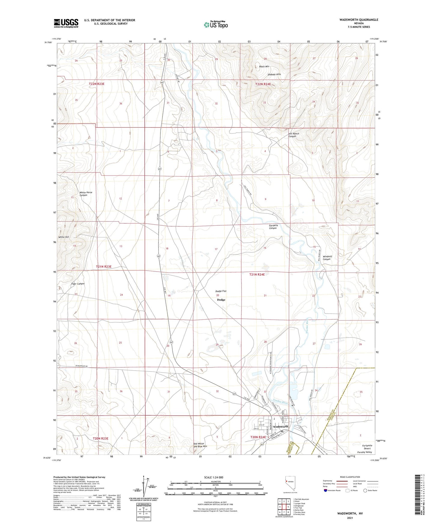
2021 topographic map quadrangle Wadsworth in the state of Nevada. Scale: 1:24000. Based on the newly updated USGS 7.5' US Topo map series, this map is in the following counties: Washoe, Lyon, Storey. The map contains contour data, water features, and other items you are used to seeing on USGS maps, but also has updated roads and other features. This is the next generation of topographic maps. Printed on high-quality waterproof paper with UV fade-resistant inks.
Quads adjacent to this one:
West: Olinghouse
Northwest: Pah Rah Mountain
North: Nixon
Northeast: Juniper Peak
East: Two Tips
Southeast: Fernley East
South: Fernley West
Southwest: Derby Dam
This map covers the same area as the classic USGS quad with code o39119f3.
Contains the following named places: CAA Station, Dead Ox Wash, Diabase Hills, Dodge, Dodge Flat, Fort Defiance Creek, Gardella Canyon, Herstin, Hill Ranch Canyon, Hills, James Ranch, Lower Crossing, Millers Creek, Natchez Elementary School, Red White and Blue Mountain, Thomas Ranch, Tiger Canyon, Wadsworth, Wadsworth Airport, Wadsworth Census Designated Place, Wadsworth Post Office, White Horse Canyon, Windmill Canyon