MyTopo
The Elbow Oregon US Topo Map
Couldn't load pickup availability
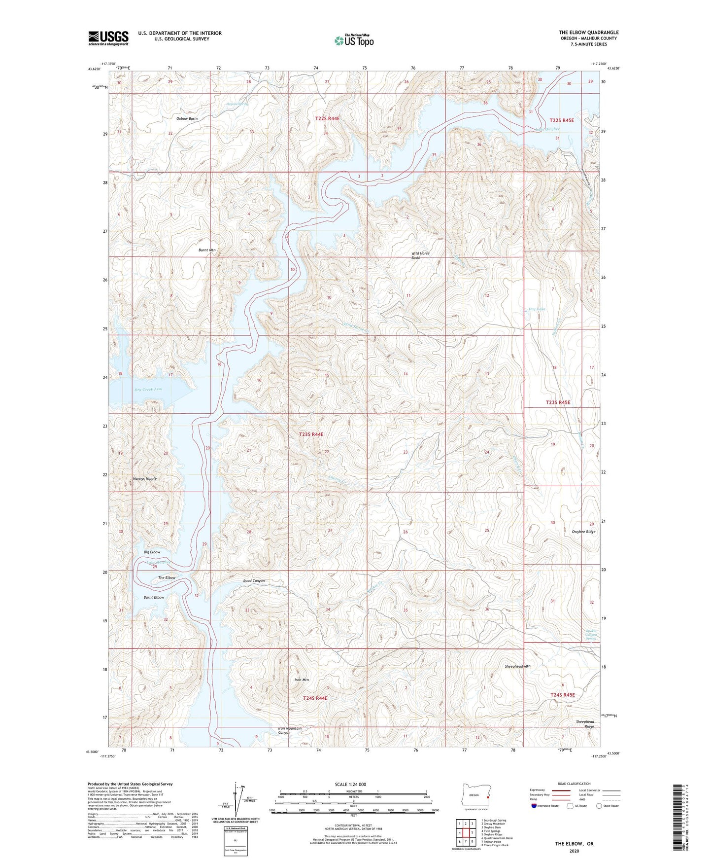
2024 topographic map quadrangle The Elbow in the state of Oregon. Scale: 1:24000. Based on the newly updated USGS 7.5' US Topo map series, this map is in the following counties: Malheur. The map contains contour data, water features, and other items you are used to seeing on USGS maps, but also has updated roads and other features. This is the next generation of topographic maps. Printed on high-quality waterproof paper with UV fade-resistant inks.
Quads adjacent to this one:
West: Twin Springs
Northwest: Sourdough Spring
North: Grassy Mountain
Northeast: Owyhee Dam
East: Owyhee Ridge
Southeast: Three Fingers Rock
South: Pelican Point
Southwest: Quartz Mountain Basin
This map covers the same area as the classic USGS quad with code o43117e3.
Contains the following named places: Big Elbow, Birch Creek, Burnt Elbow, Burnt Mountain, Cherry Creek, Deer Creek, Dry Creek, Dry Creek Arm, Dry Lake, Indian Creek, Indian Creek Campground Boat Ramp, Iron Mountain, Iron Mountain Canyon, Lake Owyhee, Lake Owyhee McCormack State Park Boat Ramp, Nannys Nipple, Owyhee Ridge, Oxbow Basin, Oxyoke Spring, Road Canyon, Rookie Canyon Spring, Rookie Creek, Sheephead Mountain, The Elbow, V W McCormack Area, Wild Horse Basin, Wild Horse Creek, ZIP Code: 97913