MyTopo
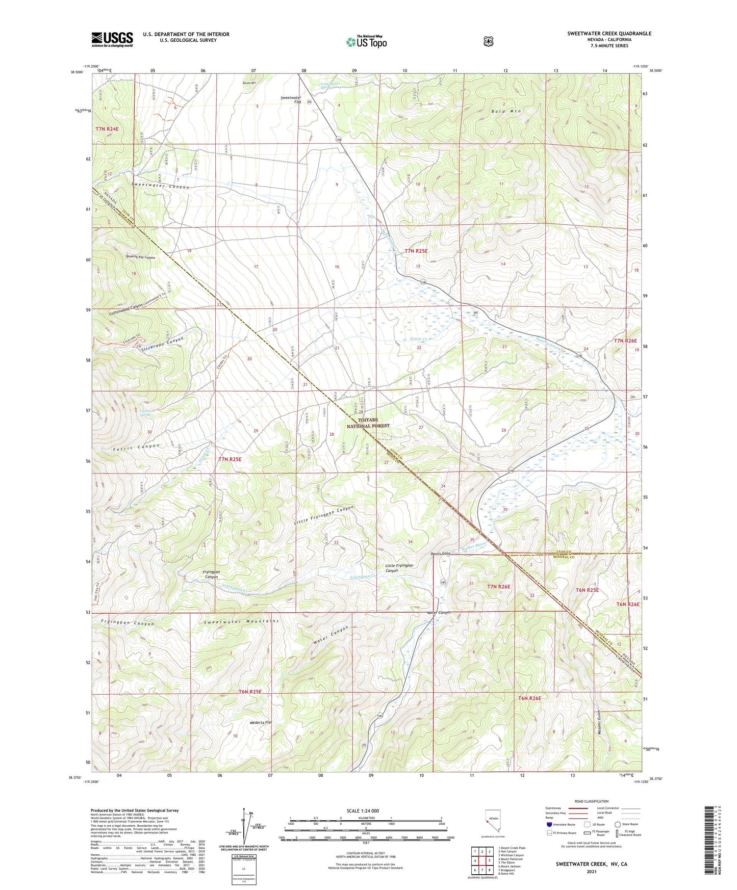
Sweetwater Creek Nevada US Topo Map
Couldn't load pickup availability
Also explore the Sweetwater Creek Forest Service Topo of this same quad for updated USFS data
2021 topographic map quadrangle Sweetwater Creek in the states of California, Nevada. Scale: 1:24000. Based on the newly updated USGS 7.5' US Topo map series, this map is in the following counties: Lyon, Mono, Mineral. The map contains contour data, water features, and other items you are used to seeing on USGS maps, but also has updated roads and other features. This is the next generation of topographic maps. Printed on high-quality waterproof paper with UV fade-resistant inks.
Quads adjacent to this one:
West: Mount Patterson
Northwest: Desert Creek Peak
North: Nye Canyon
Northeast: Wichman Canyon
East: The Elbow
Southeast: Dome Hill
South: Bridgeport
Southwest: Mount Jackson
This map covers the same area as the classic USGS quad with code o38119d2.
Contains the following named places: Atcheson Ranch, Clinton, Clinton Spring, Cottonwood Canyon, Devils Gate, Feridell Ranch, Ferris Canyon, Fredericks Ranch, Fryingpan Canyon, Fryingpan Creek, Green Creek, Little Fryingpan Canyon, Long Doctor Spring, Masonic Gulch, Monte Cristo, Murphy Pond, Philatro Ranch, Quaking Asp Canyon, Roach Ranch, Round Mountain, Silverado Canyon, Star City, Sweetwater, Sweetwater Canyon, Sweetwater Creek, Sweetwater Flat, Sweetwater Guard Station, Sweetwater Natural Area, Sweetwater Post Office, Sweetwater Ranch, Water Canyon, Wedertz Flat, Williams Stage Station Historical Site