MyTopo
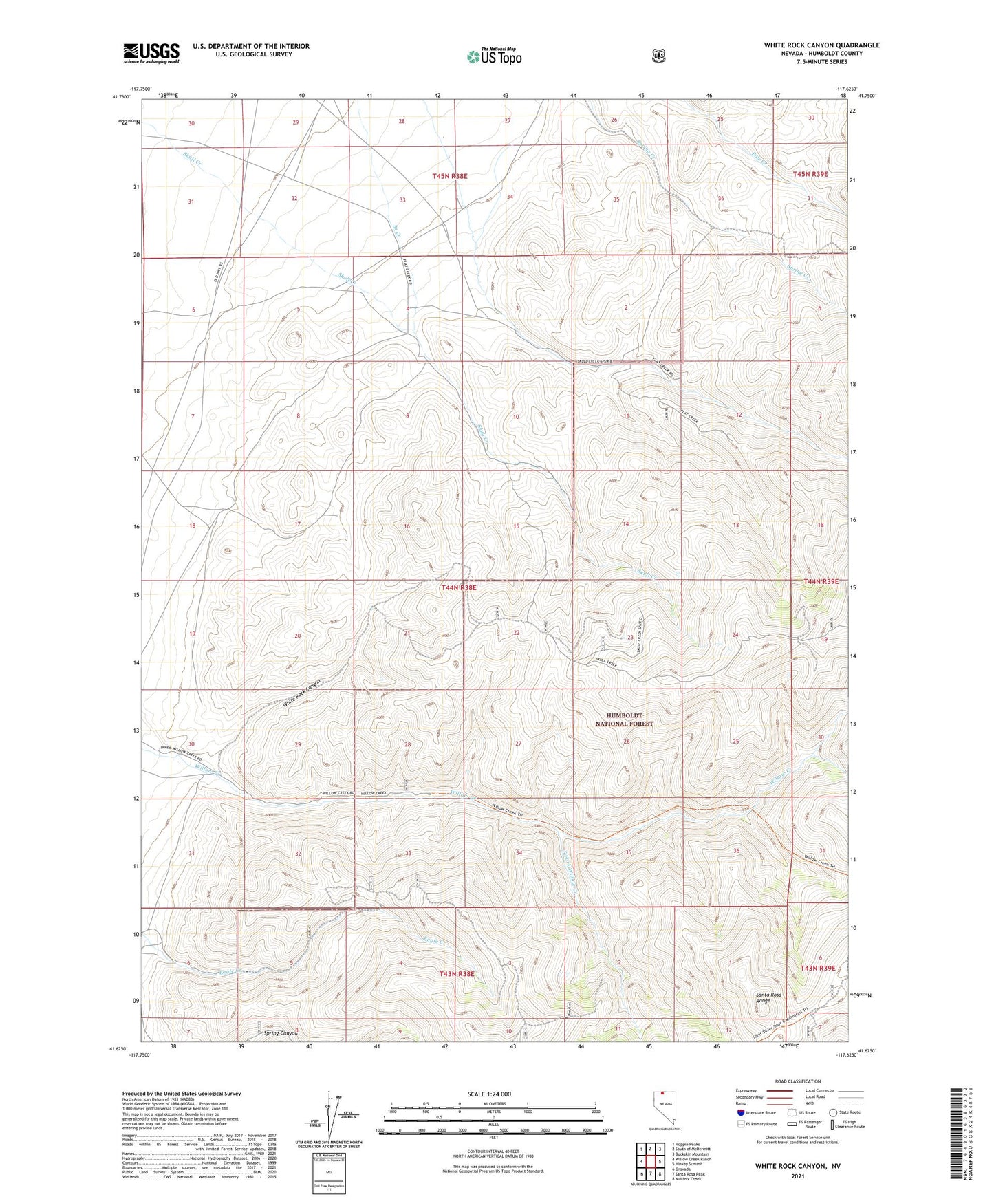
White Rock Canyon Nevada US Topo Map
Couldn't load pickup availability
Also explore the White Rock Canyon Forest Service Topo of this same quad for updated USFS data
2021 topographic map quadrangle White Rock Canyon in the state of Nevada. Scale: 1:24000. Based on the newly updated USGS 7.5' US Topo map series, this map is in the following counties: Humboldt. The map contains contour data, water features, and other items you are used to seeing on USGS maps, but also has updated roads and other features. This is the next generation of topographic maps. Printed on high-quality waterproof paper with UV fade-resistant inks.
Quads adjacent to this one:
West: Willow Creek Ranch
Northwest: Hoppin Peaks
North: South of McDermitt
Northeast: Buckskin Mountain
East: Hinkey Summit
Southeast: Mullinix Creek
South: Santa Rosa Peak
Southwest: Orovada
This map covers the same area as the classic USGS quad with code o41117f6.
Contains the following named places: Branch Creek, Charles Young Ranch, Echave Ranch, Flat Creek Ranch, Gabica Fork Willow Creek, Rebel Creek Mining District, South Fork Willow Creek, White Rock Canyon, William Stone Ranch