MyTopo
Palisade Nevada US Topo Map
Couldn't load pickup availability
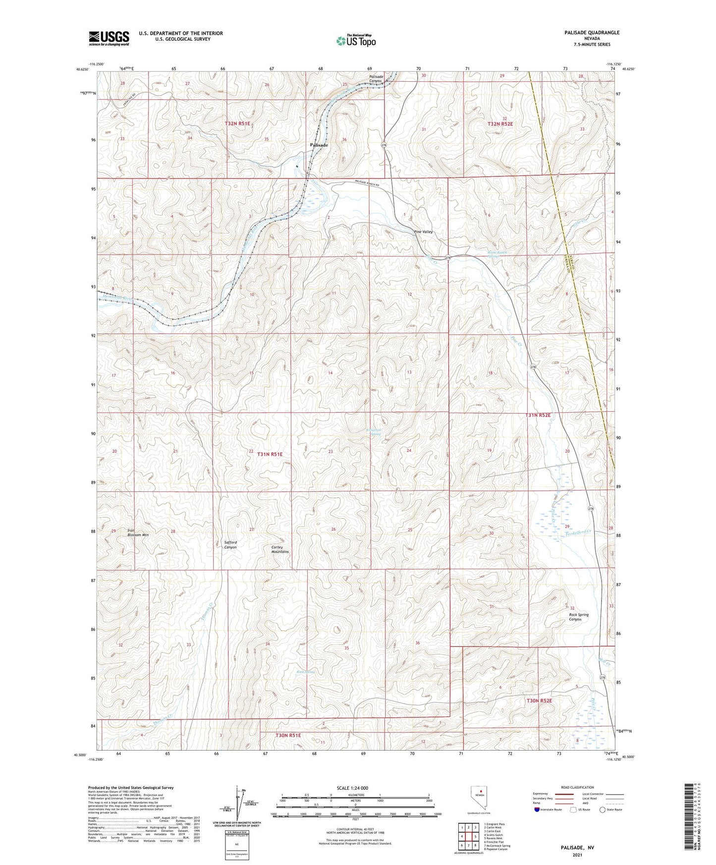
2021 topographic map quadrangle Palisade in the state of Nevada. Scale: 1:24000. Based on the newly updated USGS 7.5' US Topo map series, this map is in the following counties: Eureka, Elko. The map contains contour data, water features, and other items you are used to seeing on USGS maps, but also has updated roads and other features. This is the next generation of topographic maps. Printed on high-quality waterproof paper with UV fade-resistant inks.
Quads adjacent to this one:
West: Scotts Gulch
Northwest: Emigrant Pass
North: Carlin West
Northeast: Carlin East
East: Ravens Nest
Southeast: Papoose Canyon
South: McCormack Spring
Southwest: Frenchie Flat
This map covers the same area as the classic USGS quad with code o40116e2.
Contains the following named places: Cole Creek, Duggan Spur, Emigrant Spring, Ferdelford Creek, Gerald, Gerald Post Office, Iron Blossom Mountain, Mill Creek, Palisade, Palisade Post Office, Palisades Four Dam, Palisades Three Dam, Palisades Two Dam, Pine Creek, Pine Valley, Raine Ranch, Raine Ranch Springs, Raines, Rock Spring, Rock Spring Canyon, Stumps, Thomas Place, Tomera Ranch, ZIP Code: 89822