MyTopo
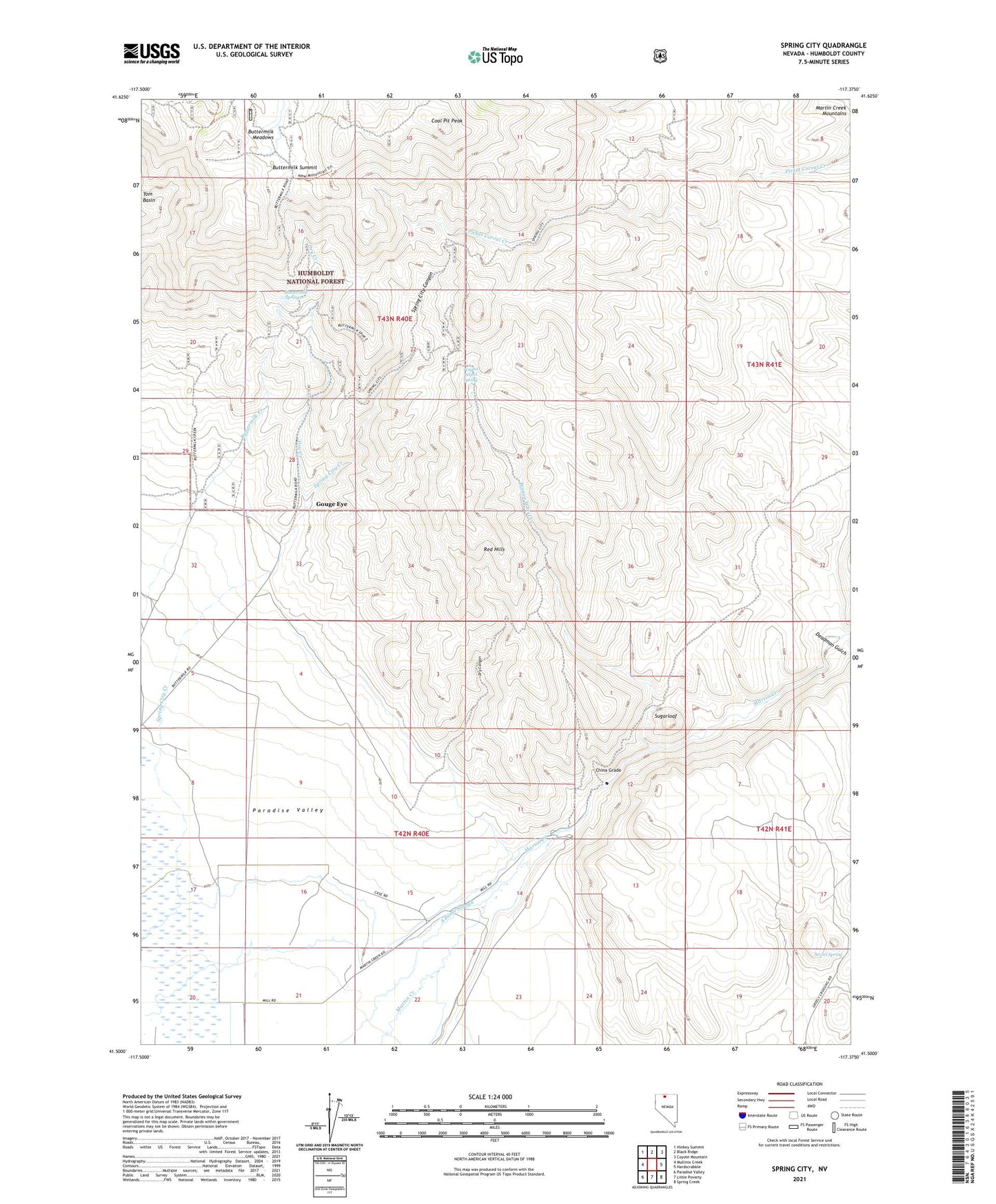
Spring City Nevada US Topo Map
Couldn't load pickup availability
Also explore the Spring City Forest Service Topo of this same quad for updated USFS data
2021 topographic map quadrangle Spring City in the state of Nevada. Scale: 1:24000. Based on the newly updated USGS 7.5' US Topo map series, this map is in the following counties: Humboldt. The map contains contour data, water features, and other items you are used to seeing on USGS maps, but also has updated roads and other features. This is the next generation of topographic maps. Printed on high-quality waterproof paper with UV fade-resistant inks.
Quads adjacent to this one:
West: Mullinix Creek
Northwest: Hinkey Summit
North: Black Ridge
Northeast: Coyote Mountain
East: Hardscrabble
Southeast: Spring Creek
South: Little Poverty
Southwest: Paradise Valley
This map covers the same area as the classic USGS quad with code o41117e4.
Contains the following named places: Ansotegui Ranch, Bullion, Buttermilk Meadows, Buttermilk Springs, Buttermilk Summit, Cerri Ranch, China Grade, China Road, Coal Pit Creek, Coal Pit Peak, Deadman Gulch, Dry Canyon, Dry Creek, Gouge Eye, Humboldt County Fish Hatchery, Old Mill Ranch, Paradise Mill, Paradise Mining District, Paradise Valley Mining District, Queen City, Red Hills, Secret Spring, Spring City, Spring City Canyon, Spring City Creek, Spring City Post Office, Sugarloaf, Sugarloaf Dam, Wagon Wheel Creek, Wagon Wheel Spring