MyTopo
Rocky Canyon Nevada US Topo Map
Couldn't load pickup availability
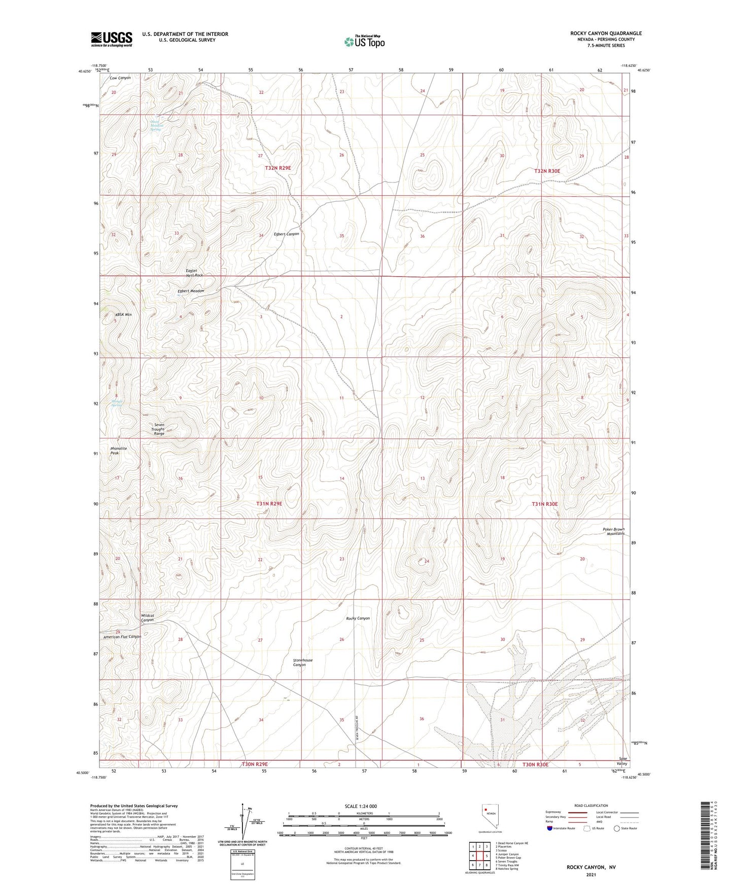
2021 topographic map quadrangle Rocky Canyon in the state of Nevada. Scale: 1:24000. Based on the newly updated USGS 7.5' US Topo map series, this map is in the following counties: Pershing. The map contains contour data, water features, and other items you are used to seeing on USGS maps, but also has updated roads and other features. This is the next generation of topographic maps. Printed on high-quality waterproof paper with UV fade-resistant inks.
Quads adjacent to this one:
West: Juniper Canyon
Northwest: Dead Horse Canyon NE
North: Placerites
Northeast: Scossa
East: Poker Brown Gap
Southeast: Natchez Spring
South: Trinity Pass NW
Southwest: Seven Troughs
This map covers the same area as the classic USGS quad with code o40118e6.
Contains the following named places: Circle L Cow Camp, Eagles Nest Rock, Egbert Canyon, Egbert Meadow, Farrell, Farrell Post Office, Hero Mine, KBSK Mountain, Marker House, Monarch Mine, Olson Meadow Spring, Phonolite Peak, Rocky Canyon, Shingle Spring, Stonehouse Canyon, Warmoth Mill, Wildcat Canyon, Wildcat Mine