MyTopo
Seyler Peak Nevada US Topo Map
Couldn't load pickup availability
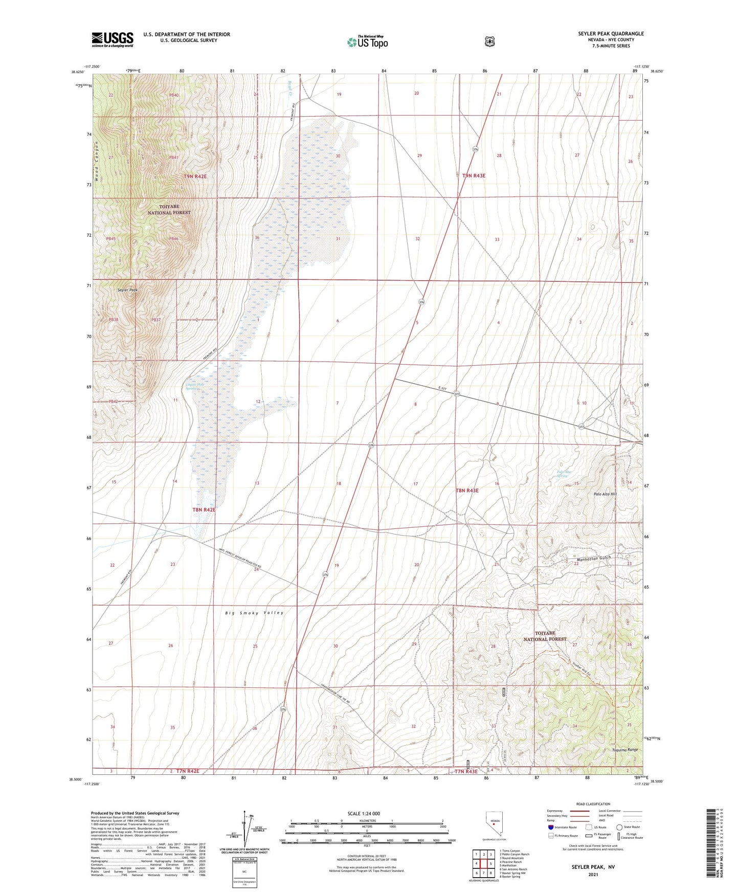
2021 topographic map quadrangle Seyler Peak in the state of Nevada. Scale: 1:24000. Based on the newly updated USGS 7.5' US Topo map series, this map is in the following counties: Nye. The map contains contour data, water features, and other items you are used to seeing on USGS maps, but also has updated roads and other features. This is the next generation of topographic maps. Printed on high-quality waterproof paper with UV fade-resistant inks.
Quads adjacent to this one:
West: Peavine Ranch
Northwest: Toms Canyon
North: Pablo Canyon Ranch
Northeast: Round Mountain
East: Manhattan
Southeast: Baxter Spring
South: Baxter Spring NW
Southwest: San Antonio Ranch
Contains the following named places: Coyote Hole Spring, Manhattan Gulch, Manhattan Placer, Palo Alto, Palo Alto Hill, Palo Alto Spring, Seyler Peak, Seyler Reservoir, Seyler Reservoir Dam