MyTopo
Pablo Canyon Ranch Nevada US Topo Map
Couldn't load pickup availability
Also explore the Pablo Canyon Ranch Forest Service Topo of this same quad for updated USFS data
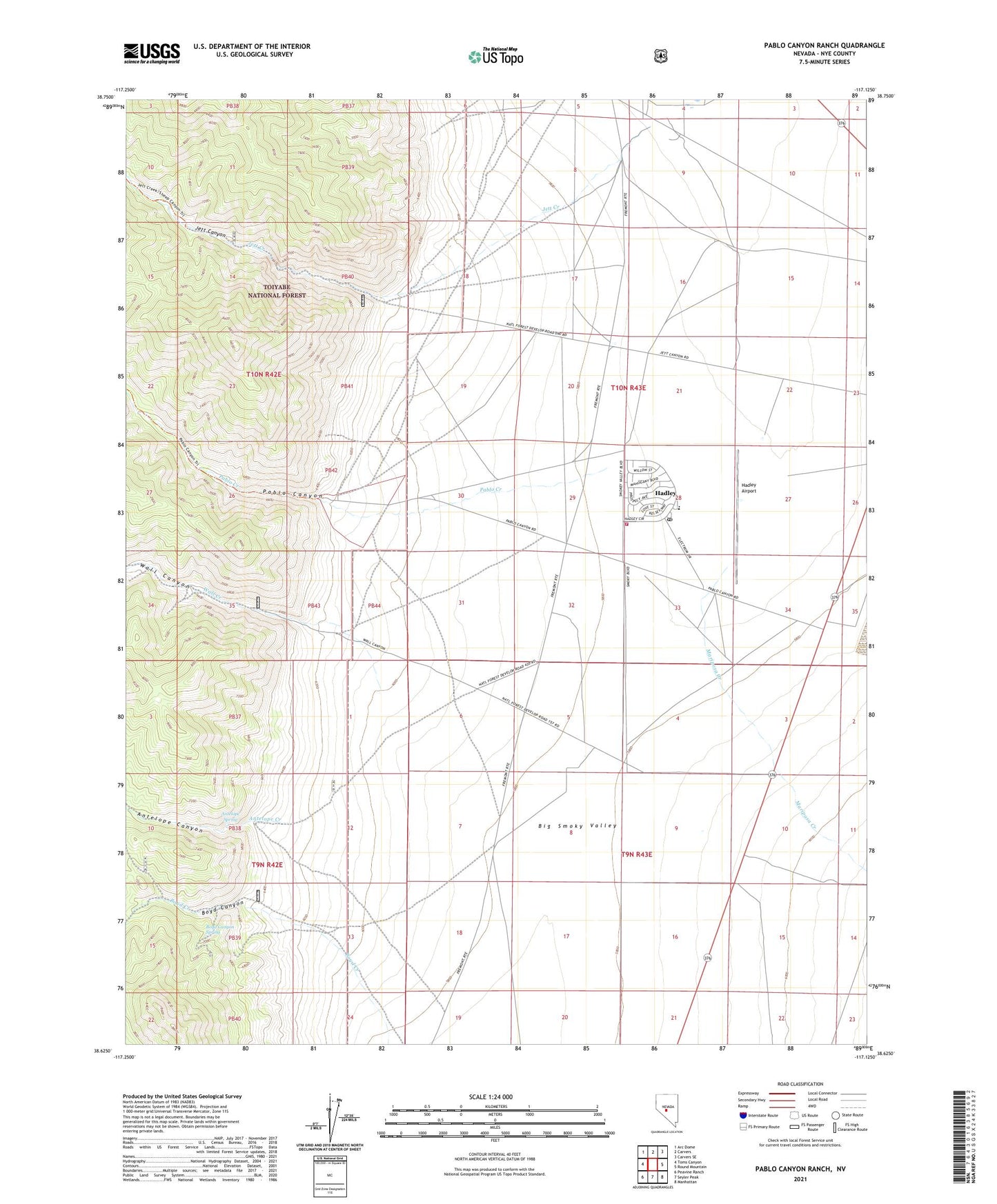
2021 topographic map quadrangle Pablo Canyon Ranch in the state of Nevada. Scale: 1:24000. Based on the newly updated USGS 7.5' US Topo map series, this map is in the following counties: Nye. The map contains contour data, water features, and other items you are used to seeing on USGS maps, but also has updated roads and other features. This is the next generation of topographic maps. Printed on high-quality waterproof paper with UV fade-resistant inks.
Quads adjacent to this one:
West: Toms Canyon
Northwest: Arc Dome
North: Carvers
Northeast: Carvers SE
East: Round Mountain
Southeast: Manhattan
South: Seyler Peak
Southwest: Peavine Ranch
This map covers the same area as the classic USGS quad with code o38117f2.
Contains the following named places: Antelope Canyon, Antelope Creek, Antelope Spring, Boyd Canyon, Boyd Canyon Spring, Boyd Creek, Gibralter Silver Mines, Hadley, Hadley Airport, Jett, Jett Canyon, Jett Creek, Jett Post Office, Pablo, Pablo Canyon, Pablo Canyon Ranch, Pablo Creek, Round Mountain Airport, Round Mountain Fire Department, Round Mountain Post Office, Wall Canyon, Wall Creek