MyTopo
Snowball Ranch Nevada US Topo Map
Couldn't load pickup availability
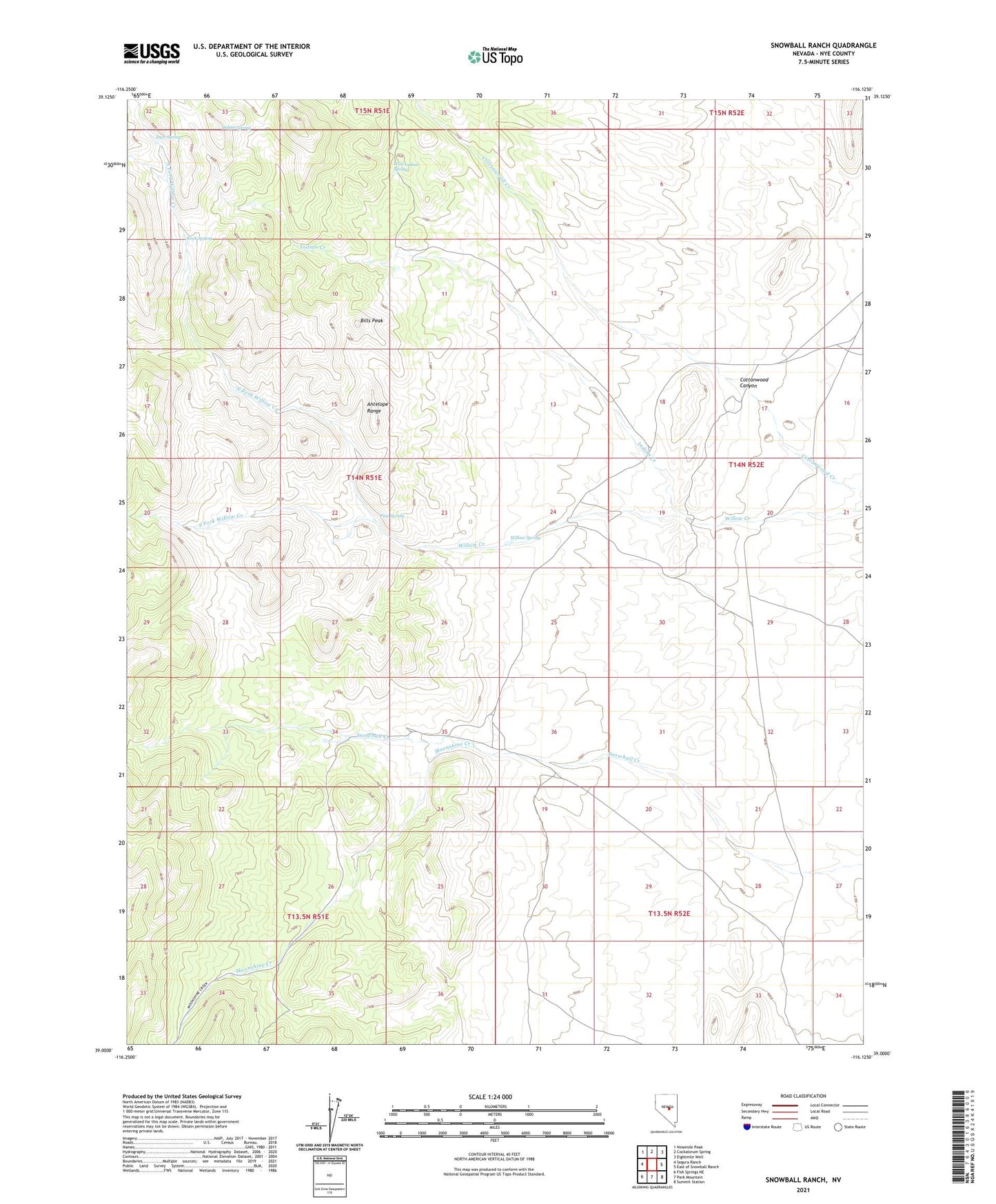
2021 topographic map quadrangle Snowball Ranch in the state of Nevada. Scale: 1:24000. Based on the newly updated USGS 7.5' US Topo map series, this map is in the following counties: Nye. The map contains contour data, water features, and other items you are used to seeing on USGS maps, but also has updated roads and other features. This is the next generation of topographic maps. Printed on high-quality waterproof paper with UV fade-resistant inks.
Quads adjacent to this one:
West: Segura Ranch
Northwest: Ninemile Peak
North: Cockalorum Spring
Northeast: Eightmile Well
East: East of Snowball Ranch
Southeast: Summit Station
South: Park Mountain
Southwest: Fish Springs NE
This map covers the same area as the classic USGS quad with code o39116a2.
Contains the following named places: Bills Peak, Cottonwood Canyon, Deer Spring, Indian Creek, Indian Spring, Indian Spring Ranch, Moonshine Creek, North Fork Willow Creek, Pine Spring, Rock Spring, Sawmill, Snowball Ranch, South Fork Willow Creek, Wild Indian Spring, Willow Creek Ranch, Willow Spring