MyTopo
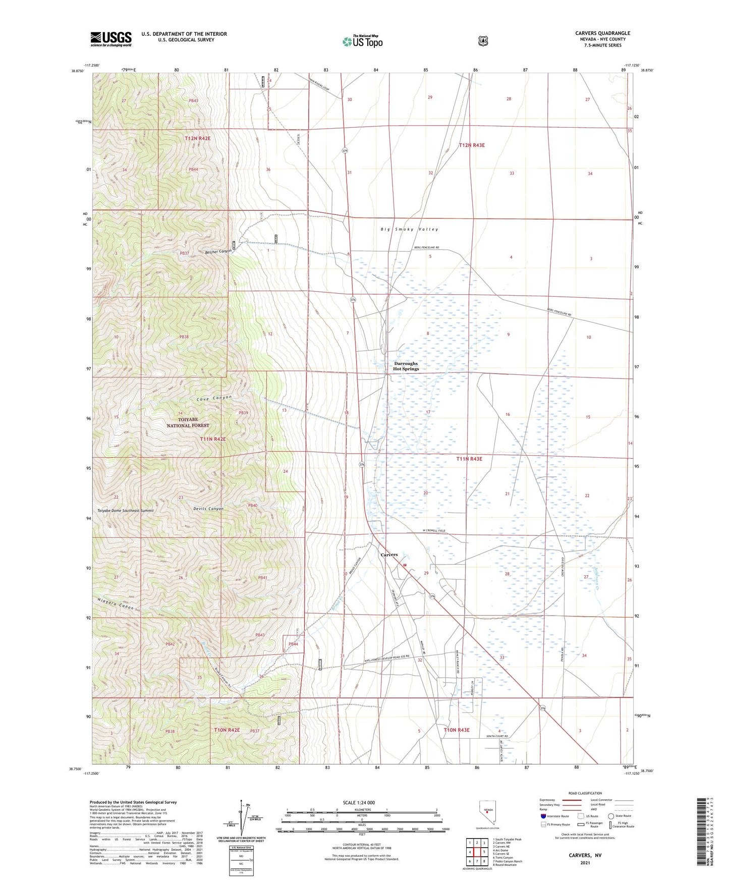
Carvers Nevada US Topo Map
Couldn't load pickup availability
Also explore the Carvers Forest Service Topo of this same quad for updated USFS data
2021 topographic map quadrangle Carvers in the state of Nevada. Scale: 1:24000. Based on the newly updated USGS 7.5' US Topo map series, this map is in the following counties: Nye. The map contains contour data, water features, and other items you are used to seeing on USGS maps, but also has updated roads and other features. This is the next generation of topographic maps. Printed on high-quality waterproof paper with UV fade-resistant inks.
Quads adjacent to this one:
West: Arc Dome
Northwest: South Toiyabe Peak
North: Carvers NW
Northeast: Carvers NE
East: Carvers SE
Southeast: Round Mountain
South: Pablo Canyon Ranch
Southwest: Toms Canyon
This map covers the same area as the classic USGS quad with code o38117g2.
Contains the following named places: Belcher Canyon, Bergs Ranch, Big Smoky Highway Maintenance Station, Broad Creek, Carvers, Carvers Roadside Rest Area, Cove Canyon, Darroughs Hot Springs, Darroughs Stage Station, Devils Canyon, Howard Ranch, Indian Creek, Jefferson Creek, M and O Ranch Airport, Niagara Canon, Round Mountain Township, Smokey Valley Ambulance Service, Smokey Valley Fire Department, Smoky Valley Forest Service Facility, Toiyabe Dome Southeast Summit, Twin River Ranch, Wine Glass Ranch Airport, Wineglass Ranch