MyTopo
Stockton Flat Well Nevada US Topo Map
Couldn't load pickup availability
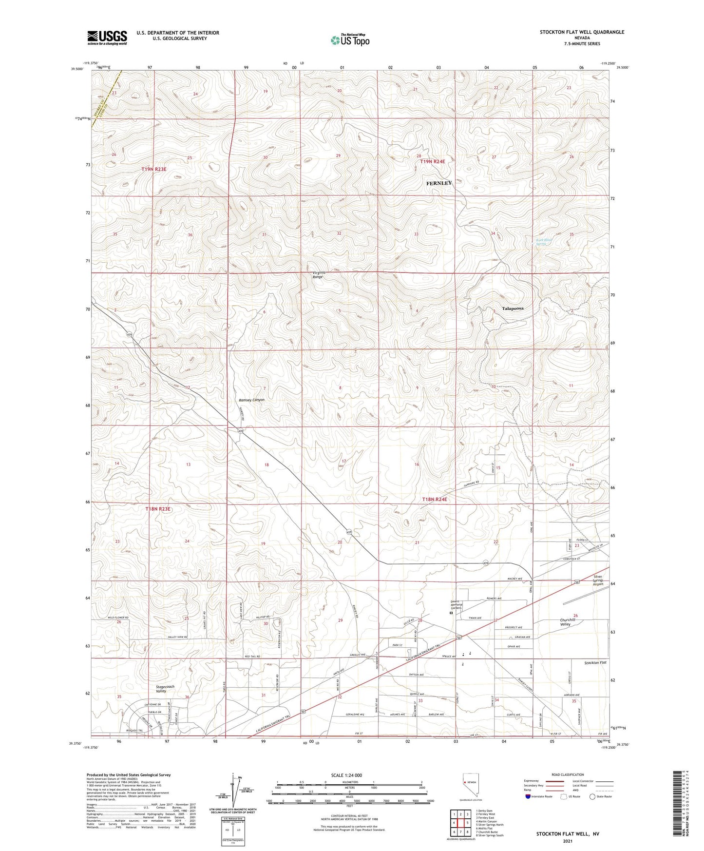
2021 topographic map quadrangle Stockton Flat Well in the state of Nevada. Scale: 1:24000. Based on the newly updated USGS 7.5' US Topo map series, this map is in the following counties: Lyon, Storey. The map contains contour data, water features, and other items you are used to seeing on USGS maps, but also has updated roads and other features. This is the next generation of topographic maps. Printed on high-quality waterproof paper with UV fade-resistant inks.
Quads adjacent to this one:
West: Martin Canyon
Northwest: Derby Dam
North: Fernley West
Northeast: Fernley East
East: Silver Springs North
Southeast: Silver Springs South
South: Churchill Butte
Southwest: Misfits Flat
Contains the following named places: Christianson Shaft, Clark Ranch, Desert Memorial Gardens, Dyke Adit, Everett Ranch, Old Stockton Well, Ramsey Canyon, Ramsey Station, Rock Blind Spring, Silver Springs Elementary School, Silver Stage High School, Silver Stage Middle School, Stockton Flat, Stockton Flat Well, Stockton Station, Talapoosa, Talapoosa Mines, Talapoosa Mining District, Western Nevada Regional Youth Center