MyTopo
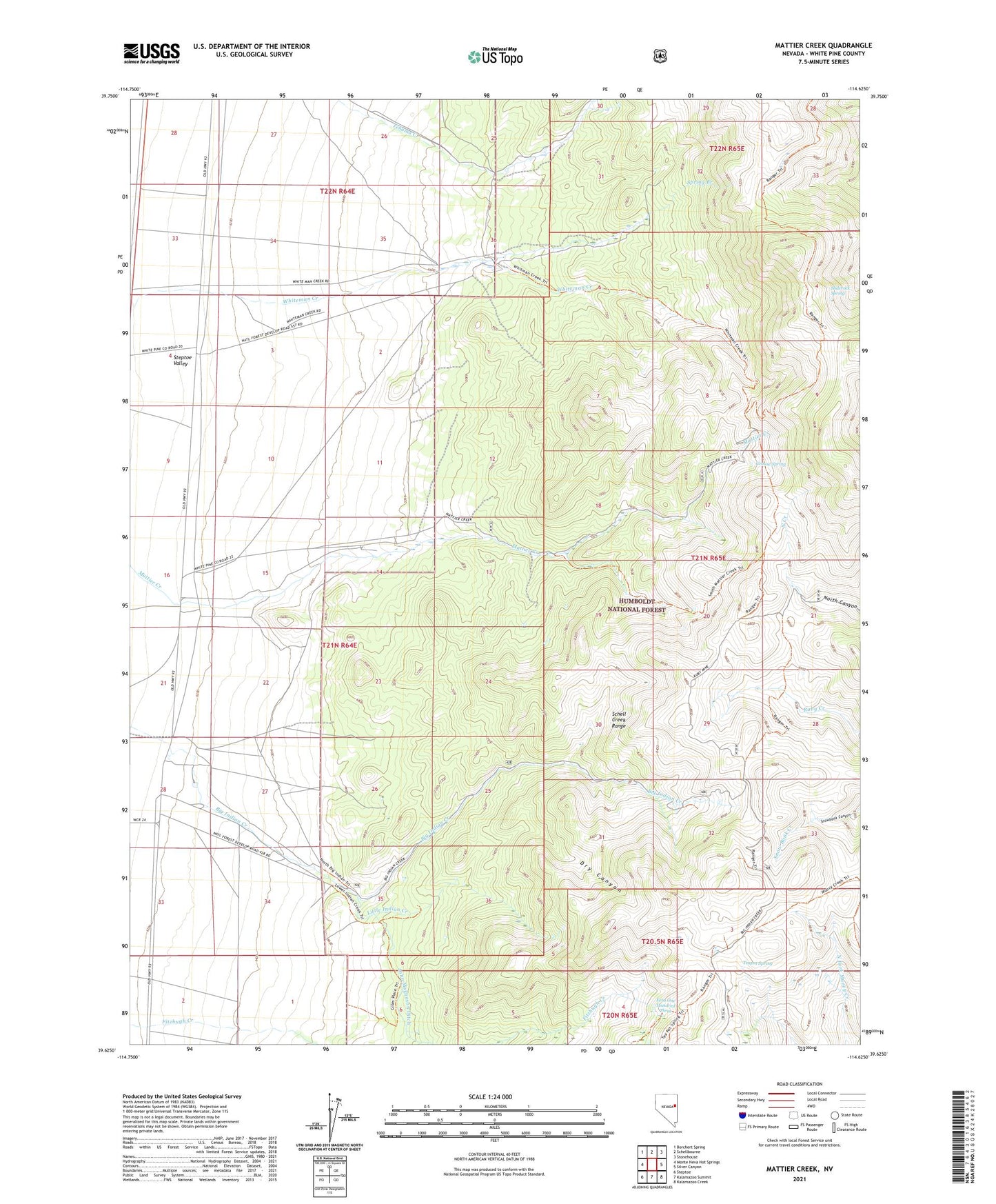
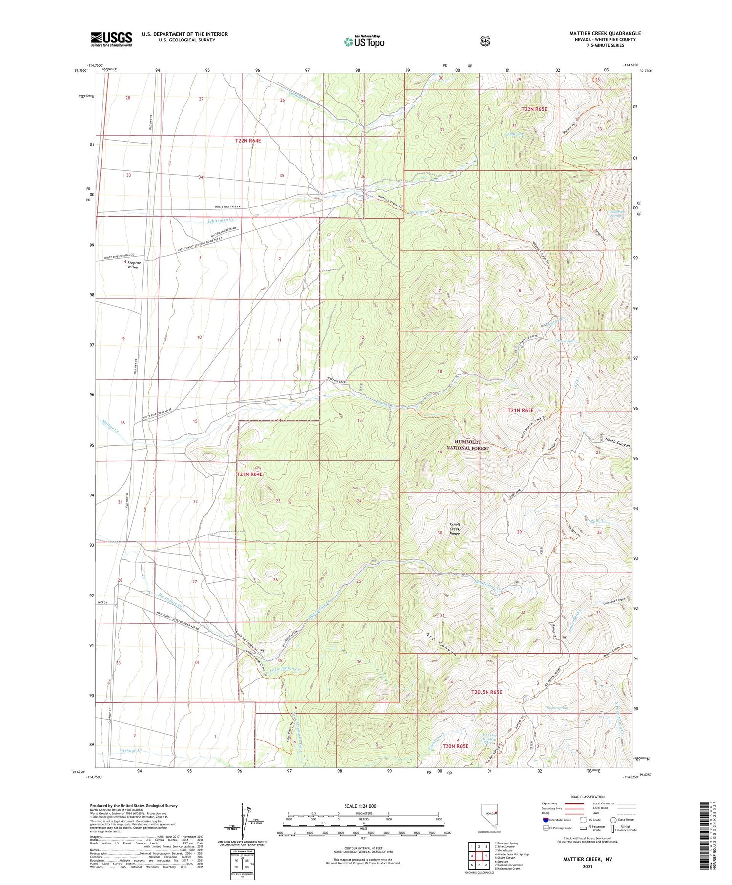
Mattier Creek Nevada US Topo Map
Couldn't load pickup availability
Also explore the Mattier Creek Forest Service Topo of this same quad for updated USFS data
2021 topographic map quadrangle Mattier Creek in the state of Nevada. Scale: 1:24000. Based on the newly updated USGS 7.5' US Topo map series, this map is in the following counties: White Pine. The map contains contour data, water features, and other items you are used to seeing on USGS maps, but also has updated roads and other features. This is the next generation of topographic maps. Printed on high-quality waterproof paper with UV fade-resistant inks.
Quads adjacent to this one:
West: Monte Neva Hot Springs
Northwest: Borchert Spring
North: Schellbourne
Northeast: Stonehouse
East: Silver Canyon
Southeast: Kalamazoo Creek
South: Kalamazoo Summit
Southwest: Steptoe
This map covers the same area as the classic USGS quad with code o39114f6.
Contains the following named places: Dry Canyon, Fera One Hundred Three, Grouse Spring, John Magnuson Ditch, Lambert Ranch, Little Indian Creek, Magnuson Ranch, Mattier Ranch, Ruby Hill, Ruby Hill Mine, Sliderock Spring, Spring Branch, Teapot Spring, Teapot Springs Administrative Site, Whiteman Creek