
MyTopo
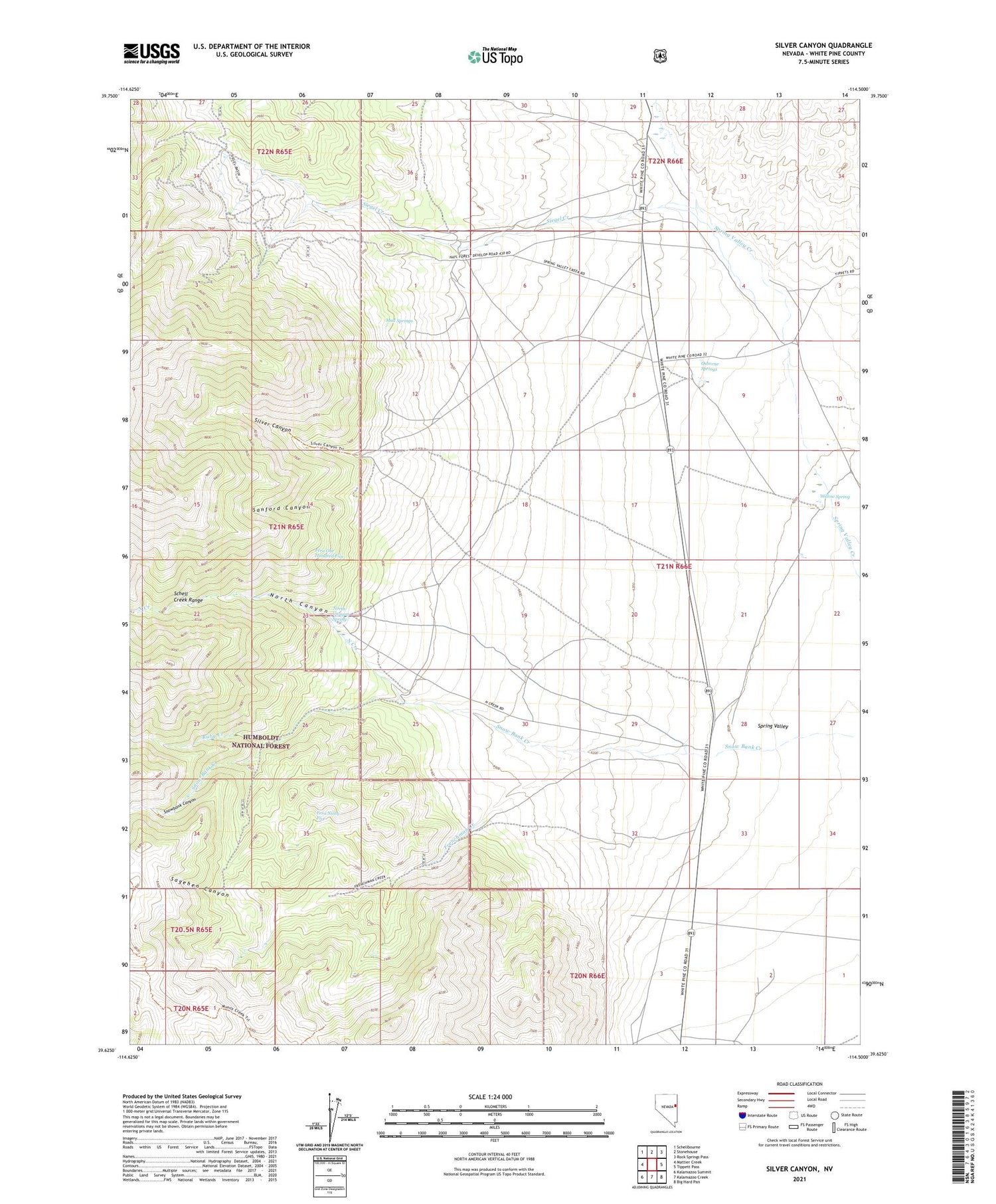
Silver Canyon Nevada US Topo Map
Couldn't load pickup availability
Also explore the Silver Canyon Forest Service Topo of this same quad for updated USFS data
2021 topographic map quadrangle Silver Canyon in the state of Nevada. Scale: 1:24000. Based on the newly updated USGS 7.5' US Topo map series, this map is in the following counties: White Pine. The map contains contour data, water features, and other items you are used to seeing on USGS maps, but also has updated roads and other features. This is the next generation of topographic maps. Printed on high-quality waterproof paper with UV fade-resistant inks.
Quads adjacent to this one:
West: Mattier Creek
Northwest: Schellbourne
North: Stonehouse
Northeast: Rock Springs Pass
East: Tippett Pass
Southeast: Big Hard Pan
South: Kalamazoo Creek
Southwest: Kalamazoo Summit
This map covers the same area as the classic USGS quad with code o39114f5.
Contains the following named places: Aurum, Aurum Mill, Aurum Post Office, Centerville, Doutre Ranch, Fera Ninty Five, Fera One Hundred Five, Frenchman Creek, Greek American Mine, Little Flower Mine, Lucky Deposit Mine, McCurdy Garden, Mud Springs, Negro Abes, North Canyon, North Canyon Spring, North Creek, Osborne Springs, Pierce Ranch, Ruby Creek, Sagehen Canyon, Sanford Canyon, Siegel, Siegel Creek, Siegel Mines, Siegel Post Office, Siegel Ranch, Signal Mine, Silver Canyon, Snowbank Canyon, Sunkist, Willow Spring


