MyTopo
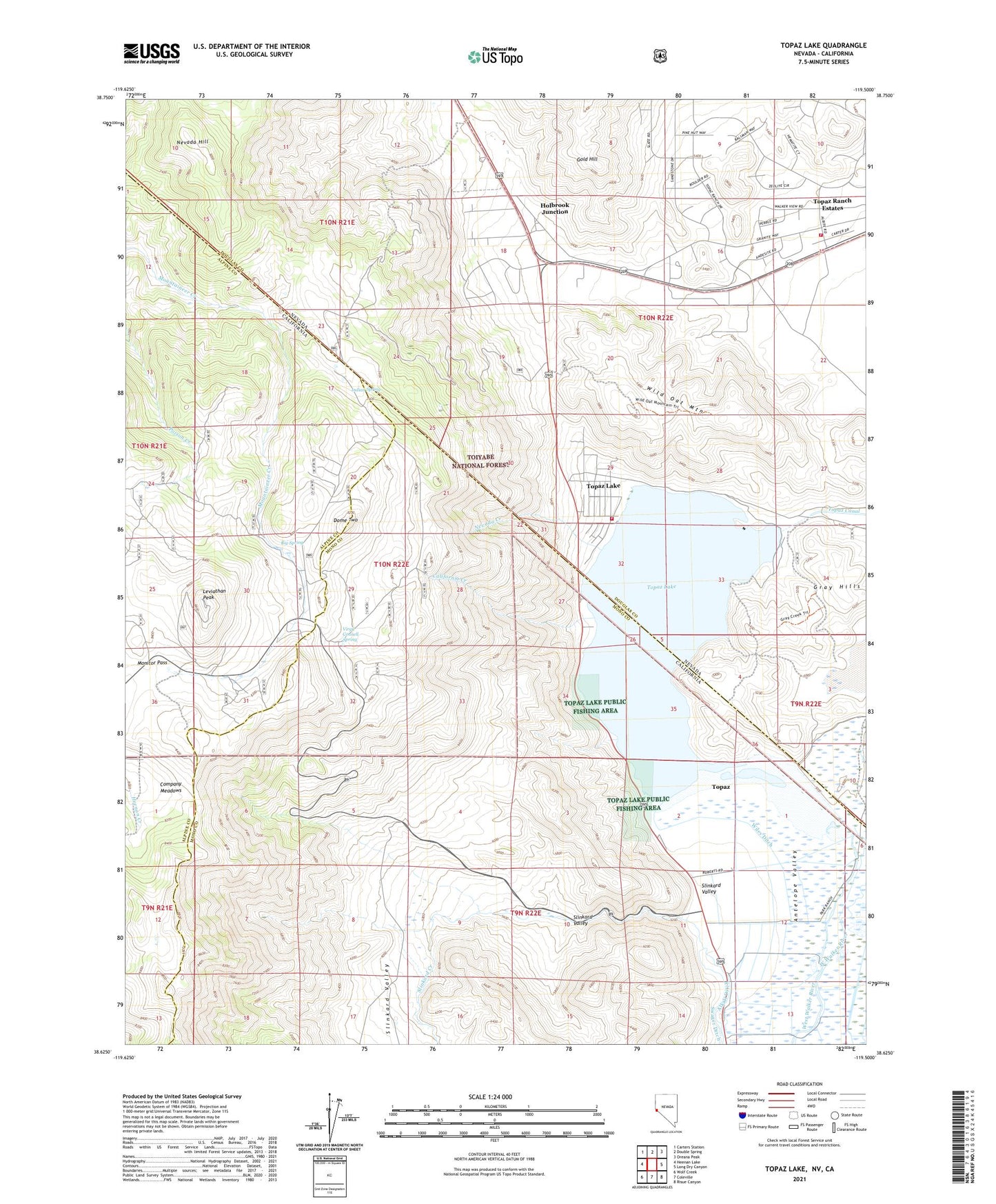
Topaz Lake Nevada US Topo Map
Couldn't load pickup availability
2021 topographic map quadrangle Topaz Lake in the states of California, Nevada. Scale: 1:24000. Based on the newly updated USGS 7.5' US Topo map series, this map is in the following counties: Douglas, Mono, Alpine. The map contains contour data, water features, and other items you are used to seeing on USGS maps, but also has updated roads and other features. This is the next generation of topographic maps. Printed on high-quality waterproof paper with UV fade-resistant inks.
Quads adjacent to this one:
West: Heenan Lake
Northwest: Carters Station
North: Double Spring
Northeast: Oreana Peak
East: Long Dry Canyon
Southeast: Risue Canyon
South: Coleville
Southwest: Wolf Creek
Contains the following named places: Big Spring, California Creek, Carson Valley Medical Center - Topaz Ranch Medical Clinic, Company Meadows, Dome Two, East Fork Fire and Paramedic Districts Station 4 Topaz Ranch Estates, East Fork Fire and Paramedic Districts Station 5 Topaz Volunteer Fire Department, East Slough, Fairfield Ranch, Gold Hill, Gray Hills, Holbrook Junction, Holbrook Post Office, Indian Spring, Kittle Kral Wells Mine, Leviathan Peak, Little Alkali Lake, Monitor Pass, Mountain House, Mountain House Rest Area, Nevada Creek, Nevada Hill, Slinkard Creek, Slinkard Valley, Tessues Bridge, Topaz Census Designated Place, Topaz Guard Station, Topaz Lake, Topaz Lake Census Designated Place, Topaz Lake Park, Topaz Lake Public Fishing Area, Topaz Ranch Estates Census Designated Place, Virgil Connell Spring, Wild Oat Mountain, Wiley Ditch, Willard-McDonald Mine