MyTopo
Coleville California US Topo Map
Couldn't load pickup availability
Also explore the Coleville Forest Service Topo of this same quad for updated USFS data
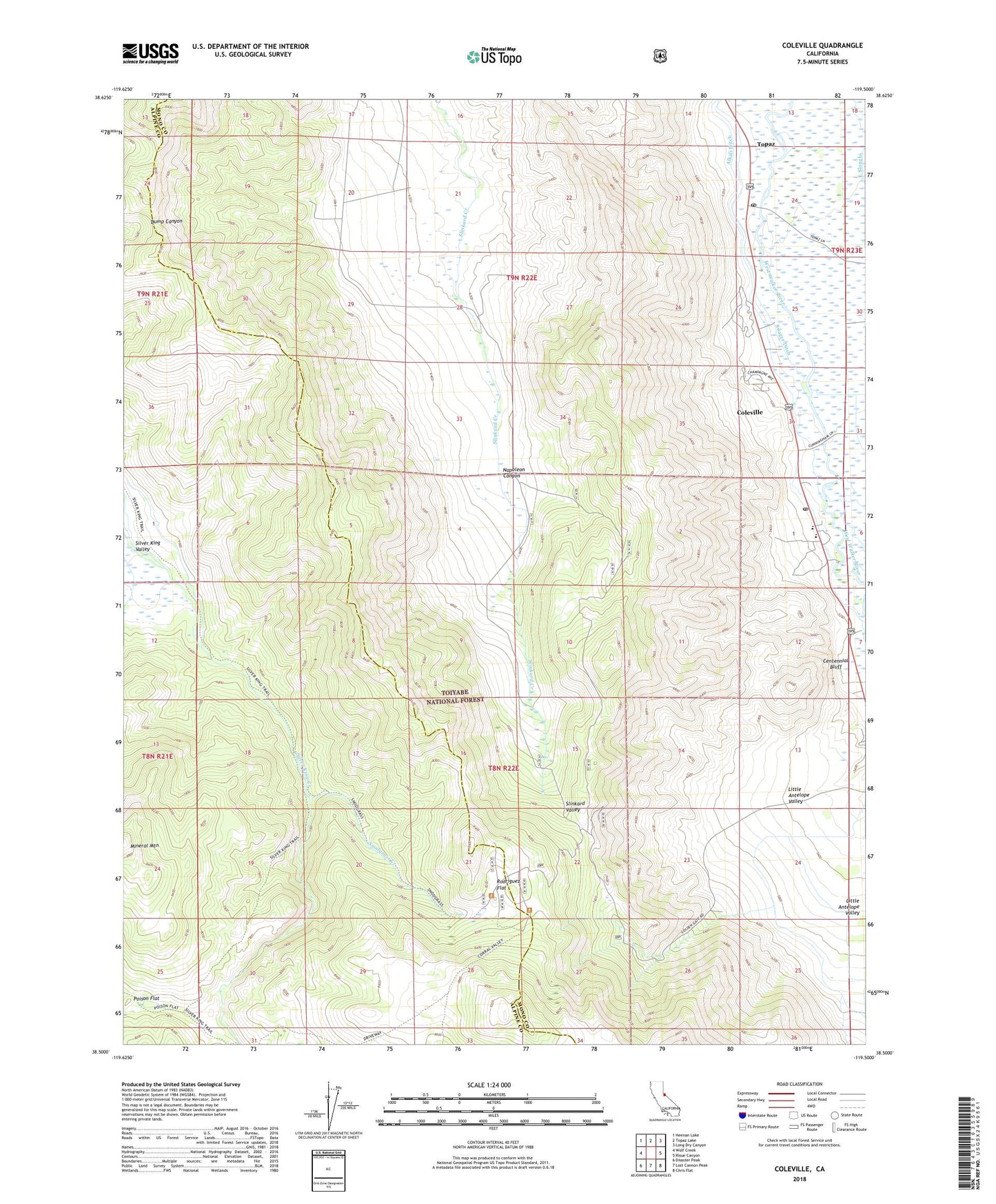
2021 topographic map quadrangle Coleville in the state of California. Scale: 1:24000. Based on the newly updated USGS 7.5' US Topo map series, this map is in the following counties: Mono, Alpine. The map contains contour data, water features, and other items you are used to seeing on USGS maps, but also has updated roads and other features. This is the next generation of topographic maps. Printed on high-quality waterproof paper with UV fade-resistant inks.
Quads adjacent to this one:
West: Wolf Creek
Northwest: Heenan Lake
North: Topaz Lake
Northeast: Long Dry Canyon
East: Risue Canyon
Southeast: Chris Flat
South: Lost Cannon Peak
Southwest: Disaster Peak
This map covers the same area as the classic USGS quad with code o38119e5.
Contains the following named places: Alkali Ditch, Antelope Elementary School, Antelope Valley Cemetery, Centennial Bluff, Coleville, Coleville Census Designated Place, Coleville High School, Coleville Post Office, Golden Gate Mine, Little Antelope Pack Station, Little Antelope Valley, Lost Canyon Trail, Napoleon Canyon, Rodriguez Flat, Snodgrass Creek, Swager Ditch, Topaz, Topaz Post Office, ZIP Code: 96133