MyTopo
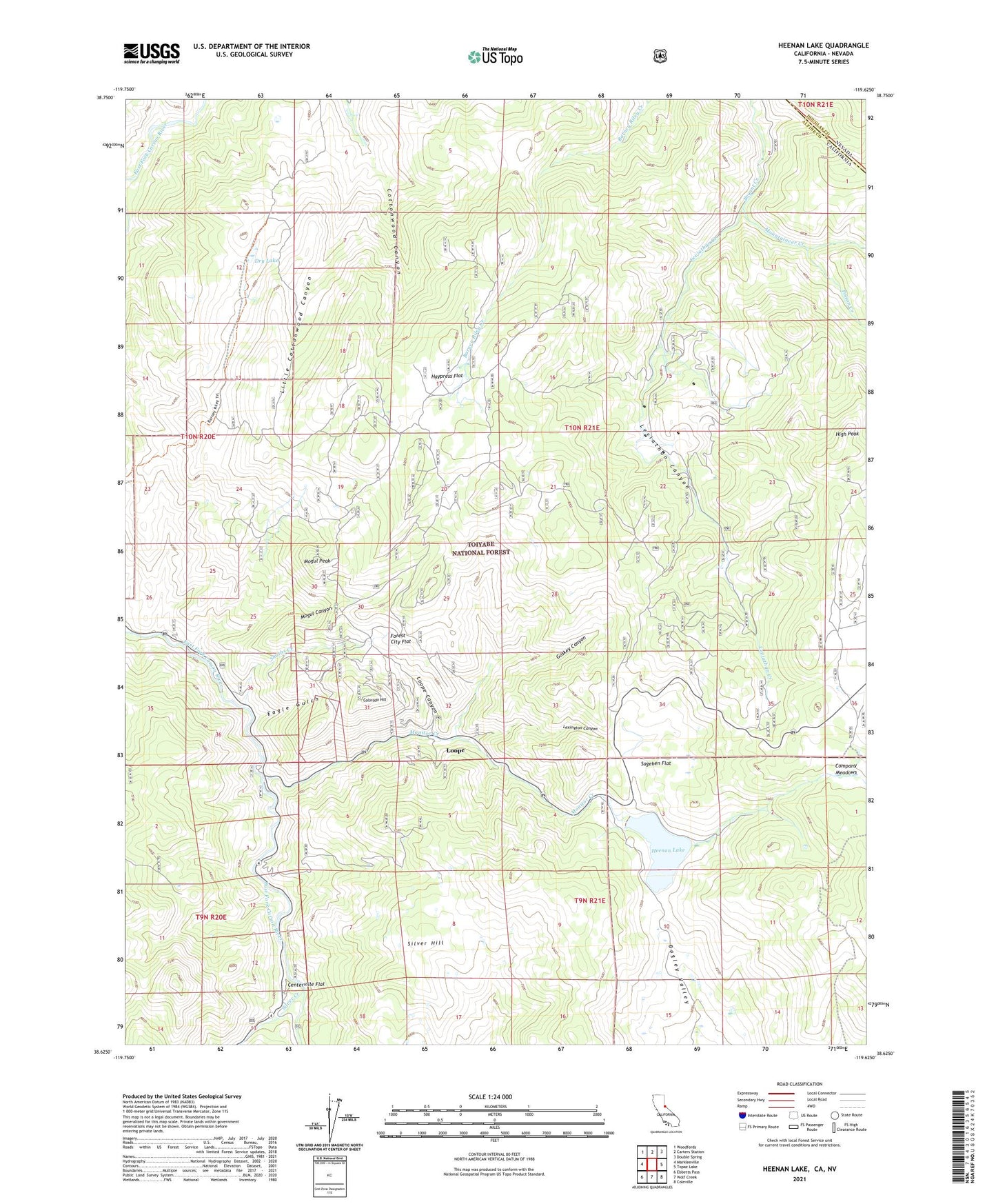
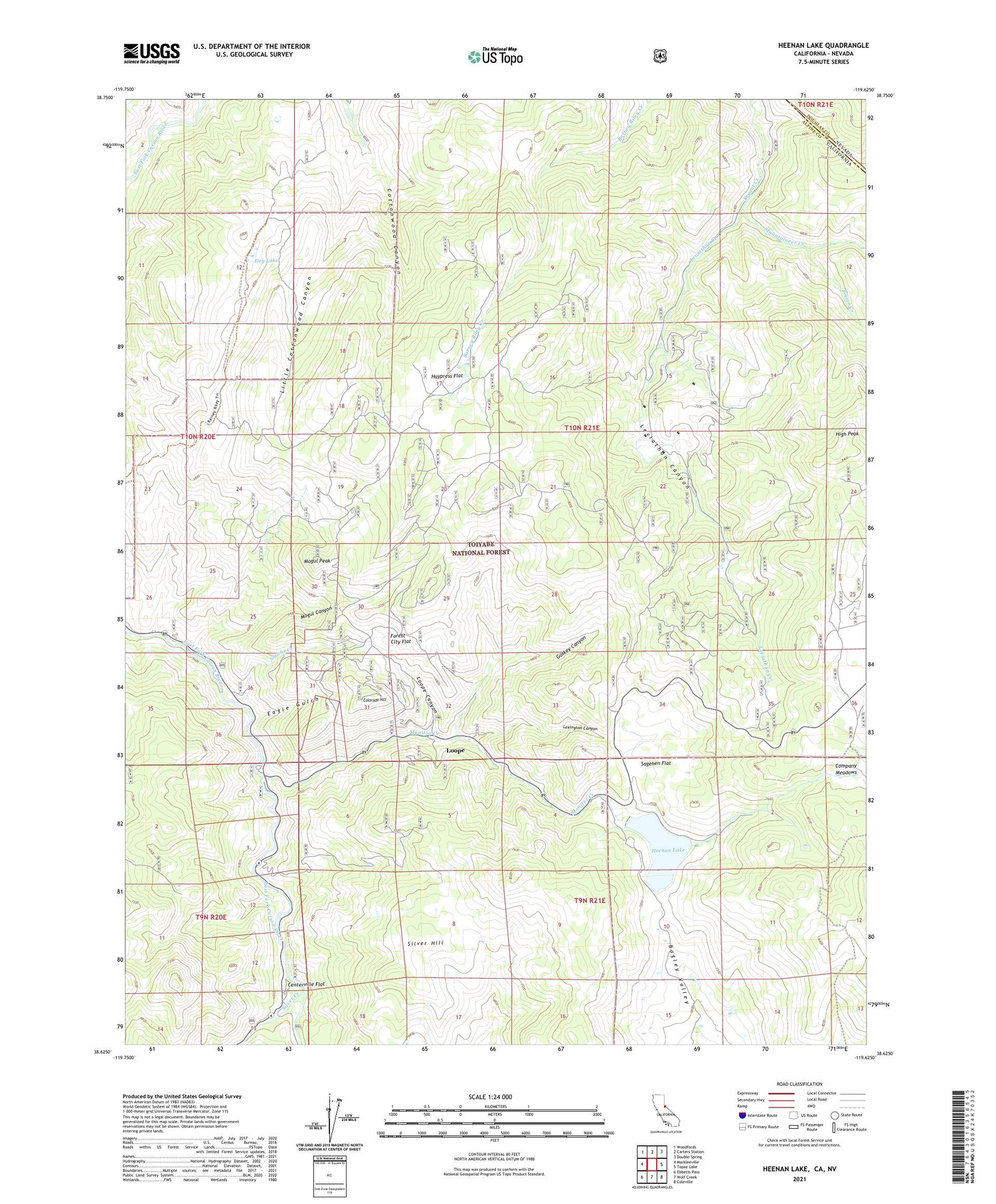
Heenan Lake California US Topo Map
Couldn't load pickup availability
Also explore the Heenan Lake Forest Service Topo of this same quad for updated USFS data
2021 topographic map quadrangle Heenan Lake in the state of California. Scale: 1:24000. Based on the newly updated USGS 7.5' US Topo map series, this map is in the following counties: Alpine, Douglas. The map contains contour data, water features, and other items you are used to seeing on USGS maps, but also has updated roads and other features. This is the next generation of topographic maps. Printed on high-quality waterproof paper with UV fade-resistant inks.
Quads adjacent to this one:
West: Markleeville
Northwest: Woodfords
North: Carters Station
Northeast: Double Spring
East: Topaz Lake
Southeast: Coleville
South: Wolf Creek
Southwest: Ebbetts Pass
Contains the following named places: Barney Riley Trail, Centerville, Centerville Bridge, Centerville Flat, Centerville Flat Campground, Colorado Hill, Curtz Mine, Dry Lake, Eagle Gulch, Forest City Flat, Globe Mine, Goskey Canyon, Haypress Flat, Heenan Creek, Heenan Lake, Heenan Lake 514 Dam, High Peak, Leviathan Creek, Leviathan Mine, Lexington Canyon, Lincoln Mine, Little Cottonwood Canyon, Loope, Loope Canyon, Mogul Canyon, Mogul Peak, Monitor Creek, Morningstar Mine, Mount Bullion, Mountaineer Creek, Poison Creek, Red Gap Mine, Sagehen Flat, Silver Creek, Silver Hill, Smiths Creek, Sunshine Mine, Zaca Mine