MyTopo
Denio Summit Nevada US Topo Map
Couldn't load pickup availability
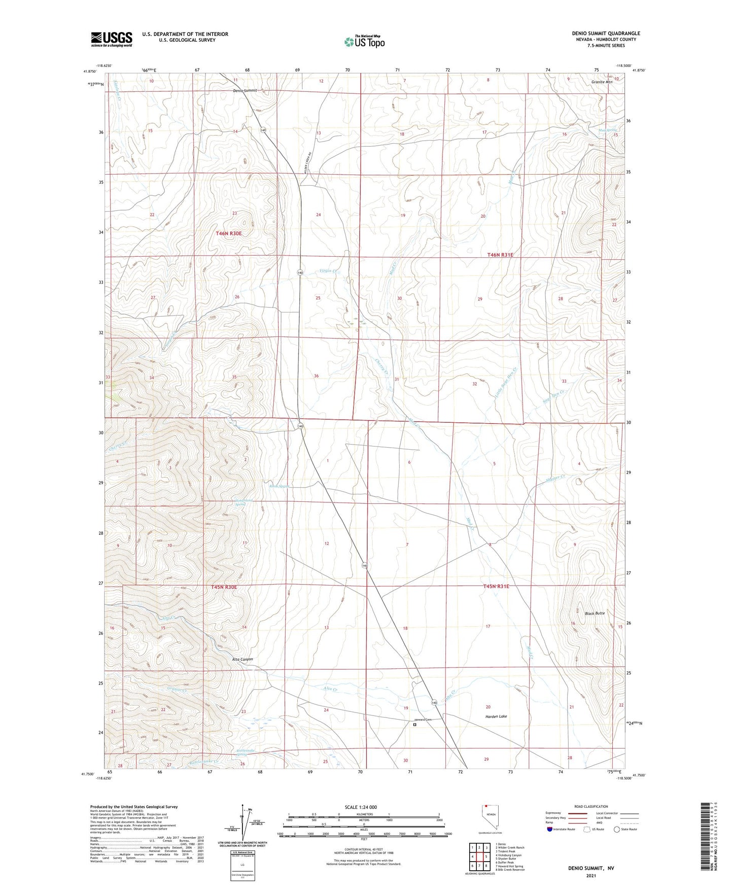
2021 topographic map quadrangle Denio Summit in the state of Nevada. Scale: 1:24000. Based on the newly updated USGS 7.5' US Topo map series, this map is in the following counties: Humboldt. The map contains contour data, water features, and other items you are used to seeing on USGS maps, but also has updated roads and other features. This is the next generation of topographic maps. Printed on high-quality waterproof paper with UV fade-resistant inks.
Quads adjacent to this one:
West: Vicksburg Canyon
Northwest: Denio
North: Wilder Creek Ranch
Northeast: Trident Peak
East: Shyster Butte
Southeast: Bilk Creek Reservoir
South: Howard Hot Spring
Southwest: Duffer Peak
This map covers the same area as the classic USGS quad with code o41118g5.
Contains the following named places: Alta Canyon, Alta Creek, Black Butte, Bramlett Stage Station, Bramlett Well, Cherry Creek, Denio Summit, Harden Lake, Harness Ranch, Hot Springs Well, Houghland Spring, Howard Cemetery, Howard Ranch, Jeff Howard Ranch, Lewis Ranch, Little Sage Hen Creek, Mud Spring, Rattlesnake Spring, Reese Spring, Rodon Ranch, Sage Hen Creek, Shyster Creek, Steves Ranch, Tregaskia Ranch, Virgin Creek, Virgin Station