MyTopo
Buck Wash Well Nevada US Topo Map
Couldn't load pickup availability
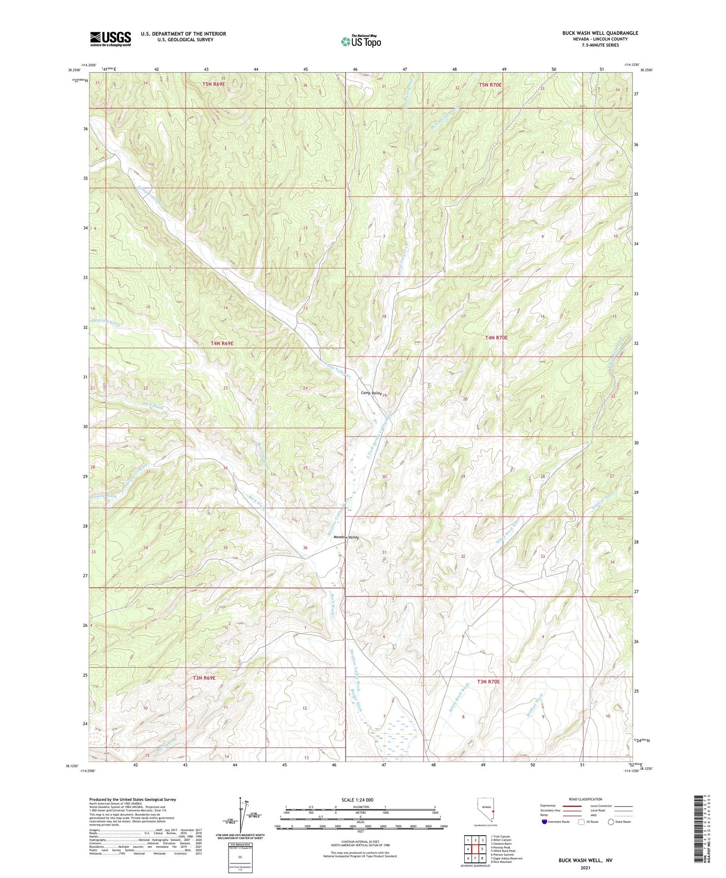
2021 topographic map quadrangle Buck Wash Well in the state of Nevada. Scale: 1:24000. Based on the newly updated USGS 7.5' US Topo map series, this map is in the following counties: Lincoln. The map contains contour data, water features, and other items you are used to seeing on USGS maps, but also has updated roads and other features. This is the next generation of topographic maps. Printed on high-quality waterproof paper with UV fade-resistant inks.
Quads adjacent to this one:
West: Parsnip Peak
Northwest: Trail Canyon
North: Miller Canyon
Northeast: Gleason Basin
East: White Rock Peak
Southeast: Rice Mountain
South: Eagle Valley Reservoir
Southwest: Pierson Summit
This map covers the same area as the classic USGS quad with code o38114b2.
Contains the following named places: Bowling Wash, Buck Wash, Buck Wash Well, Burnt Canyon Creek, Buster Wash, Camp Valley, Camp Valley Creek, Camp Valley Well, Coyote Wash, East Fork Spring Valley Wash, Meadow Valley, Mud Springs Wash, Parsnip Creek Wash, White Rock Seeding Well, White Rock Well Number One