MyTopo
Miller Canyon Nevada US Topo Map
Couldn't load pickup availability
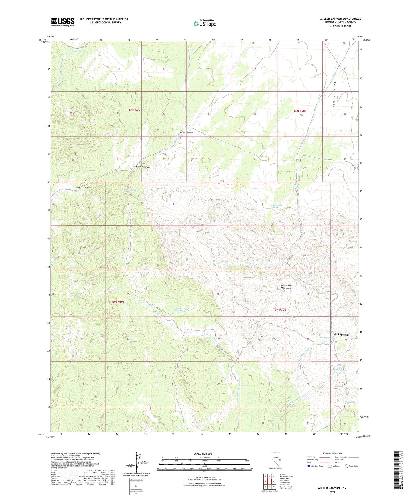
2021 topographic map quadrangle Miller Canyon in the state of Nevada. Scale: 1:24000. Based on the newly updated USGS 7.5' US Topo map series, this map is in the following counties: Lincoln. The map contains contour data, water features, and other items you are used to seeing on USGS maps, but also has updated roads and other features. This is the next generation of topographic maps. Printed on high-quality waterproof paper with UV fade-resistant inks.
Quads adjacent to this one:
West: Trail Canyon
Northwest: Atlanta
North: Rosencrans Knolls
Northeast: Hamlin Well
East: Gleason Basin
Southeast: White Rock Peak
South: Buck Wash Well
Southwest: Parsnip Peak
This map covers the same area as the classic USGS quad with code o38114c2.
Contains the following named places: Coyote Canyon, Coyote Spring, Delmue Ranch, Johnson Ranch, Lion Spring, Millard Canyon Reservoir, Miller Canyon, Mud Spring, Mud Springs, Mutton Hollow, Rattlesnake Spring, Seven Troughs Spring, Seven Troughs Wash, South Fork Spring, Upper Burnt Canyon Spring, Usave Spring