MyTopo
Bradford New Hampshire US Topo Map
Couldn't load pickup availability
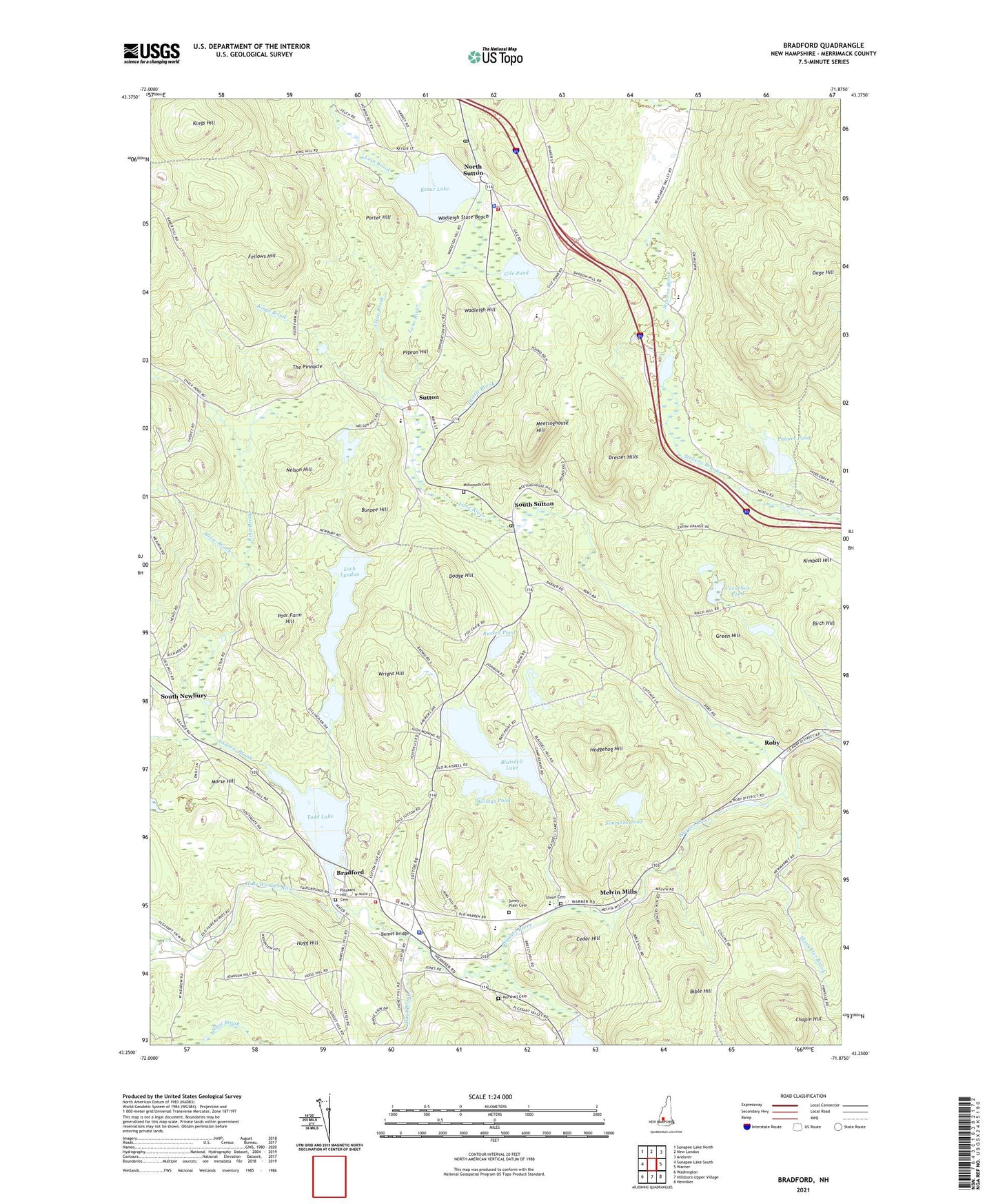
2021 topographic map quadrangle Bradford in the state of New Hampshire. Scale: 1:24000. Based on the newly updated USGS 7.5' US Topo map series, this map is in the following counties: Merrimack. The map contains contour data, water features, and other items you are used to seeing on USGS maps, but also has updated roads and other features. This is the next generation of topographic maps. Printed on high-quality waterproof paper with UV fade-resistant inks.
Quads adjacent to this one:
West: Sunapee Lake South
Northwest: Sunapee Lake North
North: New London
Northeast: Andover
East: Warner
Southeast: Henniker
South: Hillsboro Upper Village
Southwest: Washington
Contains the following named places: Andrew Brook, Bemet Bridge, Bible Hill, Billings Pond, Birch Hill, Blaisdell Lake, Blaisdell Lake Dam, Bradford, Bradford Census Designated Place, Bradford Fire Department, Bradford Pines State Forest, Bradford Police Dept, Bradford Post Office, Brown Memorial School, Burpee Hill, Camp Penacook, Cedar Hill, Central School, Chapin Hill, Cornelius Pond, Crate Brook, Dodge Hill, Dresser Hills, Fellows Hill, First Baptist Church, Gage Hill, Gile Pond, Green Hill, Hedgehog Hill, Hogg Hill, Hoyt Brook, Kearsarge Regional Elementary School at Bradford, Kearsarge Regional High School, Kearsarge Regional Middle School, Kearsarge Valley Golf Course, Kezar Lake, Kimball Hill, King Ridge Ski Area, Kings Brook, Kings Hill, Lane River, Lion Brook, Loch Lyndon, Loch Lyndon Reservoir, Loch Lyndon Reservoir Dam, Maple Leaf Golf Course, Marshall Cemetery, Meetinghouse Hill, Melvin Mills, Millwoods Cemetery, Morse Hill, Nelson Hill, North American Family Institute North The Bradford School, North Sutton, North Sutton Post Office, Palmer Pond, Pigeon Hill, Pleasant Hill Cemetery, Poor Farm Hill, Porter Hill, Ring Brook, Roby, Russell Pond, Shadow Hill State Forest, Shaw Brook, Shingle Mill Corner, Simmons Pond, Slaughter Brook, South Newbury, South Newbury Union Church, South Sutton, South Sutton Post Office, Sunny Plain Cemetery, Sutton, Sutton Central School, Sutton Police Department, Sutton Rescue Squad, Sutton Volunteer Fire Department, The Pinnacle, Thistle Brook, Todd Lake, Todd Lake Dam, Town of Sutton, Trinity Bible Church, Union Cemetery, Wadleigh Hill, Wadleigh State Beach, Wadleigh State Park, Warner River Dam, Warner River Reservoir, West Branch Warner River, Wright Hill, ZIP Codes: 03221, 03260, 03273