MyTopo
Claremont South New Hampshire US Topo Map
Couldn't load pickup availability
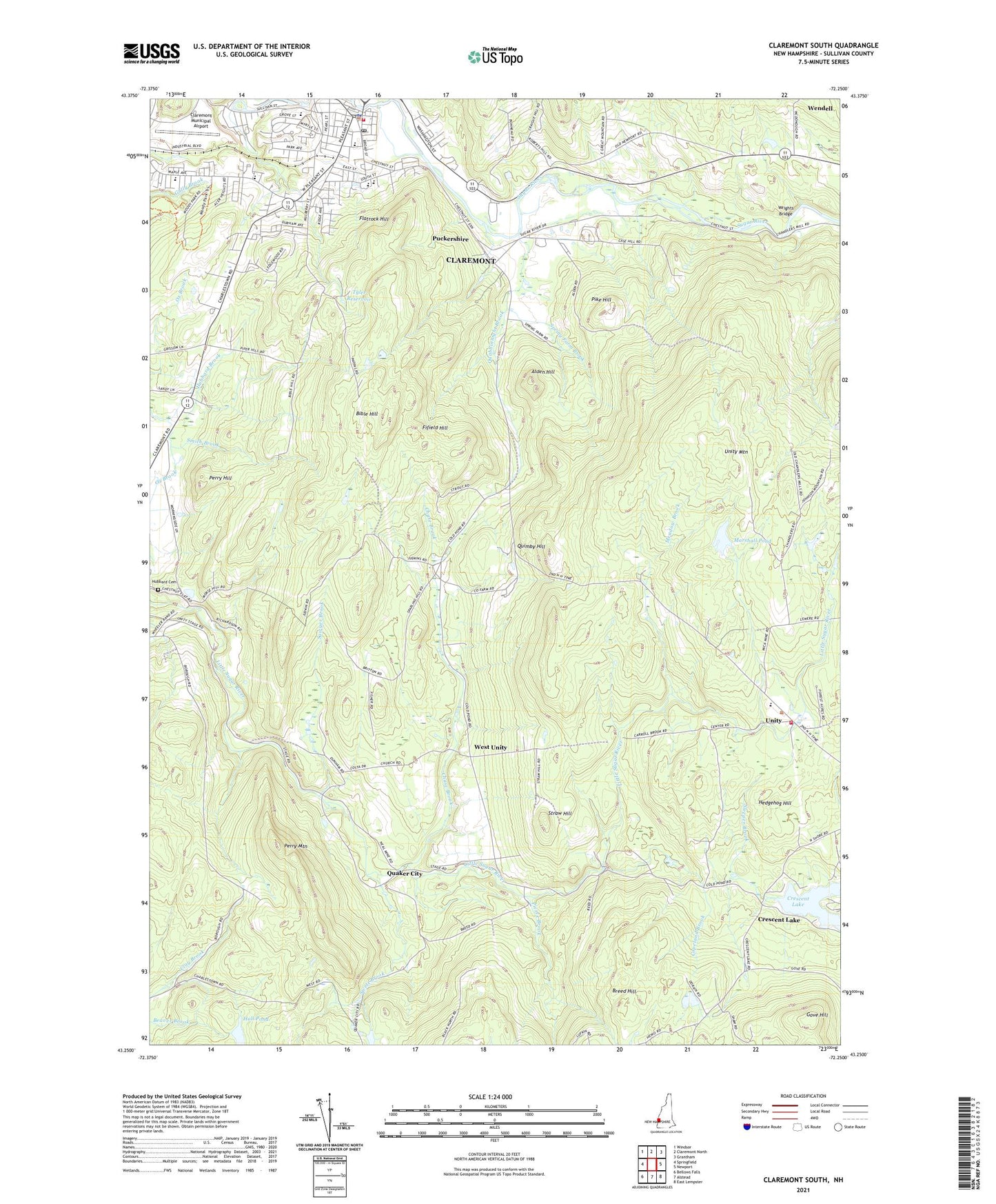
2024 topographic map quadrangle Claremont South in the state of New Hampshire. Scale: 1:24000. Based on the newly updated USGS 7.5' US Topo map series, this map is in the following counties: Sullivan. The map contains contour data, water features, and other items you are used to seeing on USGS maps, but also has updated roads and other features. This is the next generation of topographic maps. Printed on high-quality waterproof paper with UV fade-resistant inks.
Quads adjacent to this one:
West: Springfield
Northwest: Windsor
North: Claremont North
Northeast: Grantham
East: Newport
Southeast: East Lempster
South: Alstead
Contains the following named places: Alden Hill, Bible Hill, Bluff Elementary School, Breed Hill, Broad Street Park, Calvary Baptist Church, Central Business District Historic District, Chase Brook, Claremont Christian Academy, Claremont Fire Department, Claremont Middle School, Claremont Municipal Airport, Claremont Paper Company Dam, Claremont Plaza Shopping Center, Claremont Police Department, Claremont Post Office, Claremont Town Hall, Copeland Brook, Crescent Lake, Fifield Hill, Fiske Free Library, Flatrock Hill, Goodwin Community Center, Gove Hill, Hall Pond, Hall Pond Dam, Hedgehog Hill, Holy Resurrection Orthodox Church, Hubbard Brook, Hubbard Cemetery, Lower Village District, Maple Avenue Elementary School, Marshall Pond, Marshall Pond Dam, Meadow Brook, Monadnock Park, Moody Park, Old Saint Marys Roman Catholic Church, Perry Hill, Perry Mountain, Pierce Brook, Pike Hill, Puckershire, Quabbinnight Brook, Quaker City, Quimby Hill, Saint Mary School, Sawyer Brook, Sleeper Brook, Smith Brook, Spaulding Wildlife Management Area, Spring Farm Brook, Stevens High School, Straw Hill, Sugar River Reservoir, Sugar River Valley Regional Technical Center Claremont, Swett Brook, Town of Unity, Tremont Square, Trinity Episcopal Church, Tyler Reservoir, Unity, Unity Elementary School, Unity Mountain, Unity Volunteer Fire Department, Way Elementary School, West Unity, Wrights Bridge, WTSV-AM (Claremont), ZIP Code: 03743