MyTopo
Newport New Hampshire US Topo Map
Couldn't load pickup availability
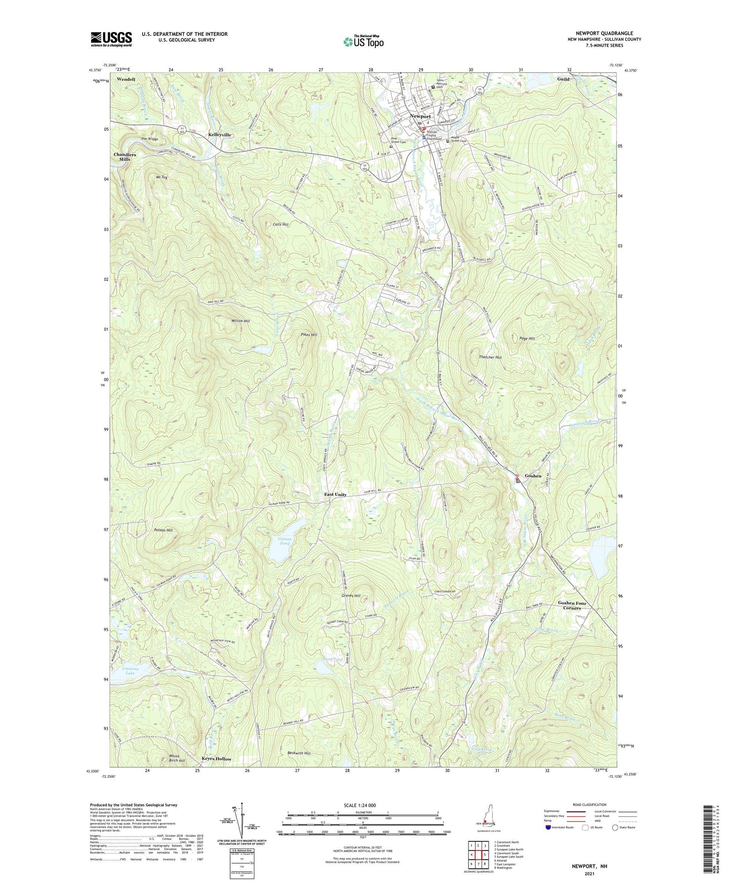
2024 topographic map quadrangle Newport in the state of New Hampshire. Scale: 1:24000. Based on the newly updated USGS 7.5' US Topo map series, this map is in the following counties: Sullivan. The map contains contour data, water features, and other items you are used to seeing on USGS maps, but also has updated roads and other features. This is the next generation of topographic maps. Printed on high-quality waterproof paper with UV fade-resistant inks.
Quads adjacent to this one:
West: Claremont South
Northwest: Claremont North
North: Grantham
Northeast: Sunapee Lake North
East: Sunapee Lake South
Southeast: Washington
South: East Lempster
Southwest: Alstead
This map covers the same area as the classic USGS quad with code o43072c2.
Contains the following named places: Babb Brook, Blood Brook, Calls Hill, Chandlers Mills, Cold Brook, Cold Brook Pond, Cold River Dam Number 8, Crescent Lake, Crows Nest Campground, Cutts Brook, East Unity, Evangelical Church, Gallop Marsh State Wildlife Management Area, Giles Brook, Gilman Pond, Gilman Pond Dam, Gordon Woolen Mill Pond, Goshen, Goshen Community Church, Goshen Emergency Medical Services, Goshen Fire Department, Goshen Four Corners, Goshen Police Department, Goshen Post Office, Graves Hill, Gunnison Brook, Hope Fellowship, Hurd Pond, John C Cain Golf Course, Kelleyville, Keyes Hollow, Little Red Schoolhouse Museum, Maple Street Cemetery, Mount Tug, Newport, Newport Area Chamber of Commerce, Newport Census Designated Place, Newport Downtown Hall, Newport Fire and Emergency Medical Services Department, Newport Fire and Emergency Medical Services Substation, Newport Medical Center, Newport Middle School, Newport Police Department, Newport Post Office, Newport Shopping Center, Newport Town Common, Newport Town Hall, Newport United Methodist Church, Page Hill, Peabody Brook, Pier Bridge, Pikes Hill, Pine Street Cemetery, Potato Hill, Professor Dam, Purmort Brook, Ram Brook, Rand Pond Campground, Richards Elementary School, Richards Free Library, Rollins Pond, Saint Patricks Cemetery, South Branch Sugar River, South Congregational Church, Spring Brook, Sugar River Dam Number 2, Sugar River Shopping Center, Sugar River Valley Regional Technical Center Newport, Sullivan County, Sullivan County Courthouse, Sullivan County Sheriff's Office, Sunshine Baptist Church, Thatcher Hill, Towle Elementary School, Town of Newport, Trask Brook, Trow Brook, Upper School, Wendell, White Birch Hill, Wilcox Hill, WNTK-AM (Newport), ZIP Code: 03773