MyTopo
East Lempster New Hampshire US Topo Map
Couldn't load pickup availability
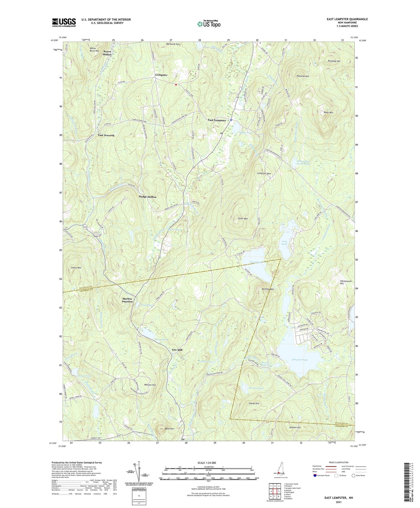
2024 topographic map quadrangle East Lempster in the state of New Hampshire. Scale: 1:24000. Based on the newly updated USGS 7.5' US Topo map series, this map is in the following counties: Sullivan, Cheshire. The map contains contour data, water features, and other items you are used to seeing on USGS maps, but also has updated roads and other features. This is the next generation of topographic maps. Printed on high-quality waterproof paper with UV fade-resistant inks.
Quads adjacent to this one:
West: Alstead
Northwest: Claremont South
North: Newport
Northeast: Sunapee Lake South
East: Washington
Southeast: Stoddard
South: Marlow
Southwest: Gilsum
This map covers the same area as the classic USGS quad with code o43072b2.
Contains the following named places: Advent Church, Ashuelot Pond, Ashuelot Pond Dam, Baker Corner, Bald Hill, Barney Brook, Barrett Pond, Bean Mountain, Beaver Brook, Beaver Pond, Beckwith Hill, Cohoos Pond, Dodge Brook, Dodge Brook State Forest, Dodge Hollow, Dodge Pond, East Acworth, East Lempster, Farnsworth Hill, Gates Mountain, Gee Brook, Gee Mill, Goshen - Lempster Cooperative School, Goshen Lampster School, Gustin Pond, Hamlin Brook, Honey Brook, Honey Brook State Forest, Huntley Mountain, Jackson Hill, John D Perkins Elementary School, Kennedy Hill, Knight Brook, Lempster, Lempster Fire Department, Lempster Mountain, Lempster Post Office, Lempster Rescue, Lewis Brook, Long Pond, Long Pond Dam, Marlow Hill, Marlow Junction, Marlow Post Office, Millen Lake, Millen Lake Dam, Miner Memorial Chapel, Parkins School, Pollards Hill, Richardson Brook, Richardson Brook Dam, Richardson Brook Pond, Russell Millpond, Sand Pond, Sand Pond Dam, Silver Mountain, Starks Hill, Stone Pond, Symonds Pond, Town of Lempster, Town of Marlow, Tracy Brook, Trout Pond, Underwood Brook, Ways Brook, ZIP Codes: 03456, 03605