MyTopo
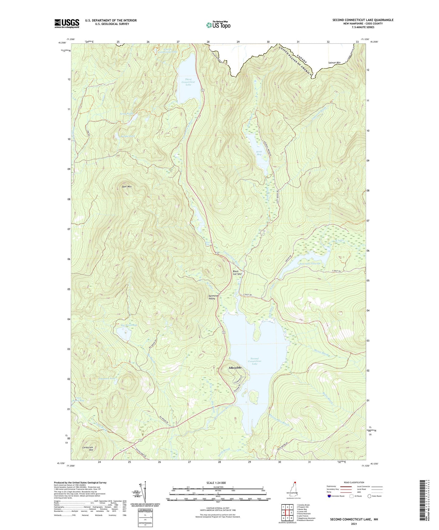
Second Connecticut Lake New Hampshire US Topo Map
Couldn't load pickup availability
2024 topographic map quadrangle Second Connecticut Lake in the state of New Hampshire. Scale: 1:24000. Based on the newly updated USGS 7.5' US Topo map series, this map is in the following counties: Coos. The map contains contour data, water features, and other items you are used to seeing on USGS maps, but also has updated roads and other features. This is the next generation of topographic maps. Printed on high-quality waterproof paper with UV fade-resistant inks.
Quads adjacent to this one:
West: Cowen Hill
Northwest: Greeley Brook
North: Prospect Hill
Northeast: Moose Bog
East: Rump Mountain
Southeast: Bosebuck Mountain
South: Magalloway Mountain
Southwest: Lake Francis
This map covers the same area as the classic USGS quad with code o45071b2.
Contains the following named places: Big Brook, Big Brook Bog, Big Brook Bog Dam, Black Cat Spur, Connecticut Lakes State Forest, Connecticut River Reservoir, Coon Brook Bog Dam, Corkscrew Hill, Deer Mountain, Deer Mountain Campground, Desmond Valley, Dry Brook, East Inlet, East Inlet Dam, East Inlet Flowage, East Inlet Pond, East Inlet Wildlife Management Area, Emery Allen Brook, Fourth Connecticut Lake, Idlewilde, Ingersoll Brook, Moose Brook, Moose Falls, Moose Falls Dam, Moose Falls Picnic ARea, Perry Ponds, Robie Brook, Salmon Mountain, Scott Bog, Scott Bog Dam, Scott Brook, Scotts Bog Wildlife Management Area, Second Connecticut Lake, Second Connecticut Lake Dam, Third Connecticut Lake, Unknown Pond, West Inlet, Wright Pond