MyTopo
New Boston New Hampshire US Topo Map
Couldn't load pickup availability
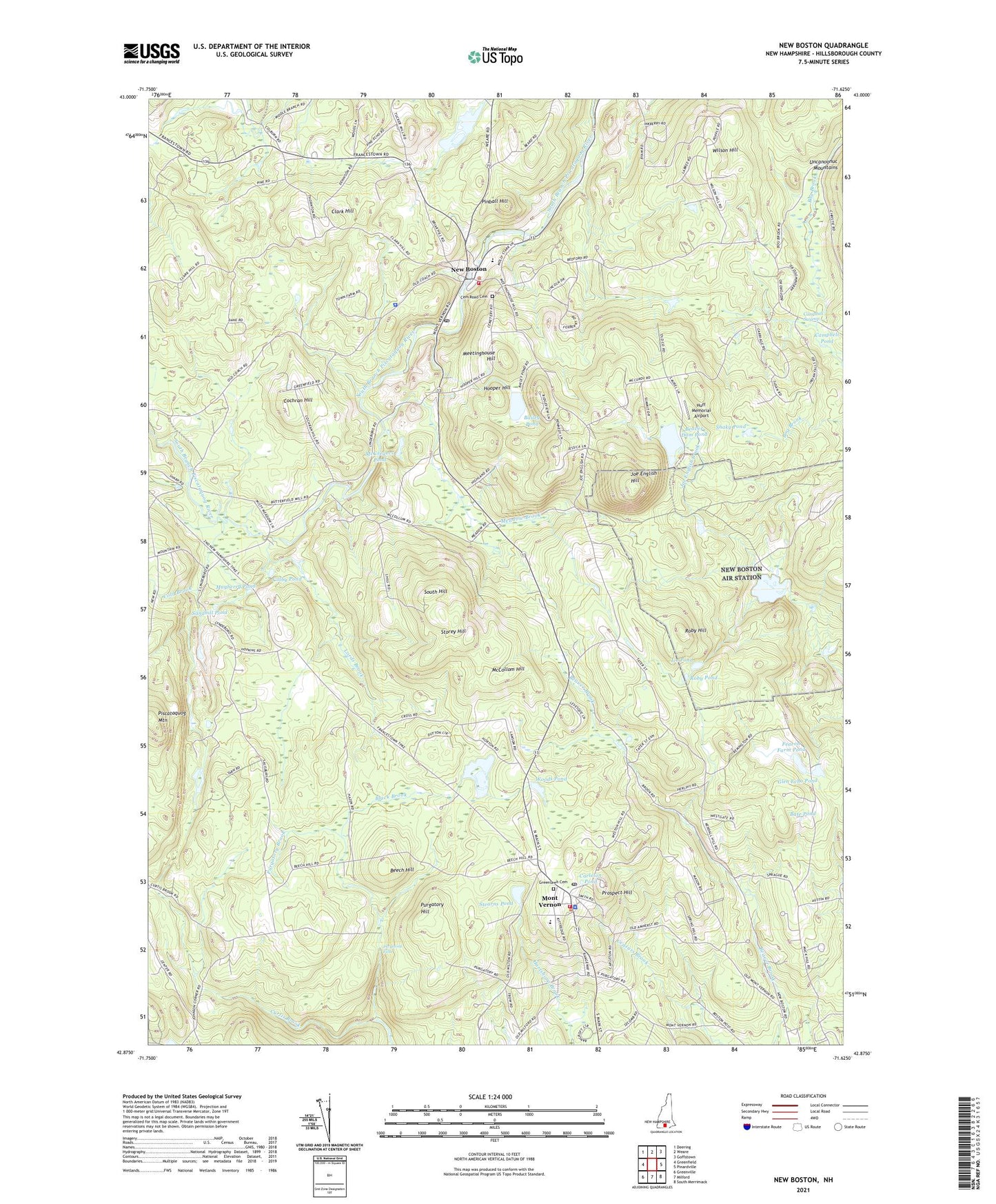
2024 topographic map quadrangle New Boston in the state of New Hampshire. Scale: 1:24000. Based on the newly updated USGS 7.5' US Topo map series, this map is in the following counties: Hillsborough. The map contains contour data, water features, and other items you are used to seeing on USGS maps, but also has updated roads and other features. This is the next generation of topographic maps. Printed on high-quality waterproof paper with UV fade-resistant inks.
Quads adjacent to this one:
West: Greenfield
Northwest: Deering
North: Weare
Northeast: Goffstown
East: Pinardville
Southeast: South Merrimack
South: Milford
Southwest: Greenville
This map covers the same area as the classic USGS quad with code o42071h6.
Contains the following named places: Austins Landing Heliport, Bailey Pond, Bate Pond, Beaver Dam Pond, Beech Hill, Black Brook, Campbell Pond, Campbell Swamp, Carleton Pond, Cemetery Road Cemetery, Clark Hill, Cochran Hill, Colby Pond, Cold Brook, Curtis Brook, Dodge Pond, Fearon Farm Pond, Fearon Farm Pond Dam, George O. Carleton Park, Glen Echo Pond, Greenlawn Cemetery, Hillsborough County, Hillsborough County Agricultural Fairgrounds, Hooper Hill, Hortons Pond, Huff Memorial Airport, Ice Pond, Joe English Hill, Joe English Pond, Johnson Corner, Klondike Corner Census Designated Place, Lords Brook, Mayberry Pond, McCollom Hill, McGregors Pond, Meadow Brook, Meetinghouse Hill, Mont Vernon, Mont Vernon Congregational Church, Mont Vernon Fire Department, Mont Vernon Police Department, Mont Vernon Post Office, Mont Vernon Village School, New Boston, New Boston Air Station, New Boston Census Designated Place, New Boston Central School, New Boston Fire Department, New Boston Police Department, New Boston Post Office, Old Country Road, Pinball Hill, Prospect Hill, Purgatory Falls, Purgatory Hill, Roby Hill, Roby Pond, Sandhill Pond, Shaky Pond, South Hill, Stearns Pond, Storey Hill, Town of Mont Vernon, Town of New Boston, Wilson Hill, Woods Pond, ZIP Codes: 03057, 03070


