MyTopo
Sunapee Lake South New Hampshire US Topo Map
Couldn't load pickup availability
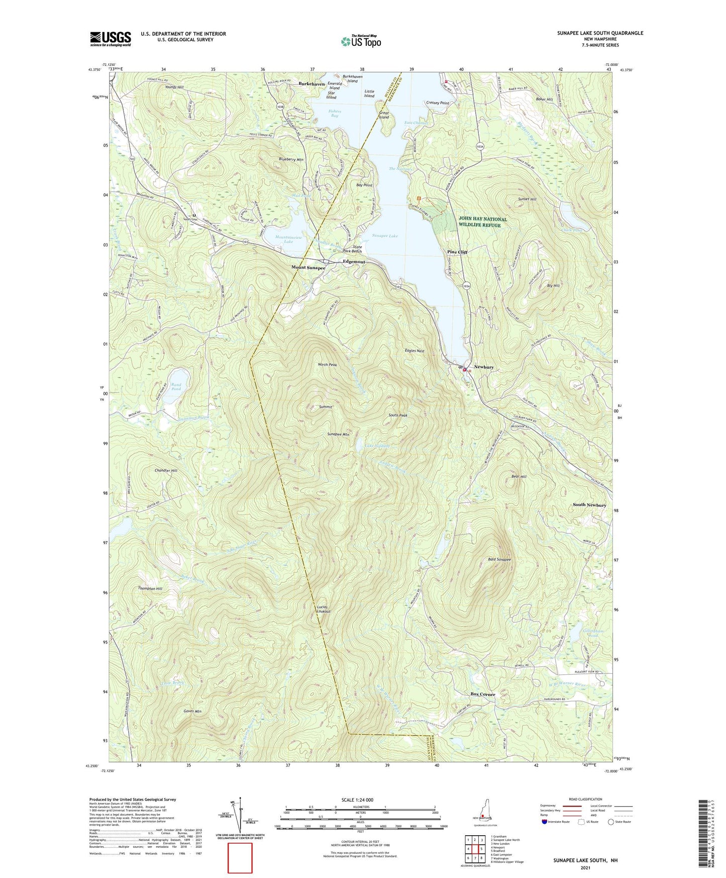
2021 topographic map quadrangle Sunapee Lake South in the state of New Hampshire. Scale: 1:24000. Based on the newly updated USGS 7.5' US Topo map series, this map is in the following counties: Merrimack, Sullivan. The map contains contour data, water features, and other items you are used to seeing on USGS maps, but also has updated roads and other features. This is the next generation of topographic maps. Printed on high-quality waterproof paper with UV fade-resistant inks.
Quads adjacent to this one:
West: Newport
Northwest: Grantham
North: Sunapee Lake North
Northeast: New London
East: Bradford
Southeast: Hillsboro Upper Village
South: Washington
Southwest: East Lempster
Contains the following named places: Baker Brook, Baker Hill, Bald Sunapee, Bay Point, Bear Hill, Blodgett Brook, Blodgett Landing, Blueberry Mountain, Bly Hill, Box Corner, Burkehaven Island, Camp Soangetaha, Center Meeting House, Chalk Pond, Chandler Brook, Chandler Hill, Cressey Point, Dexters Nordic Ski Center, Eagles Nest, East Channel, Edgemont, Emerald Island, Fishers Bay, Gillingham Pond, Goves Mountain, Great Island, Healing Springs Church, John Hay National Wildlife Refuge, Johnson Brook, Lake Solitude, Little Island, Lucias Lookout, Mount Sunapee, Mount Sunapee State Park, Mountainview Lake, Mud Pond, Newbury, Newbury Fire and Rescue Department, Newbury Fire Department Blodgett Landing Substation, Newbury Police Department, Newbury Post Office, North Peak, Pine Cliff, Rand Pond, South Cemetery, South Peak, Star Island, State Park Beach, Summit, Sunapee Mountain, Sunapee Station, Sunset Hill, The Narrows, Thompson Hill, Town of Goshen, Town of Newbury, Youngs Hill, ZIP Codes: 03255, 03752