MyTopo
Waterville Valley New Hampshire US Topo Map
Couldn't load pickup availability
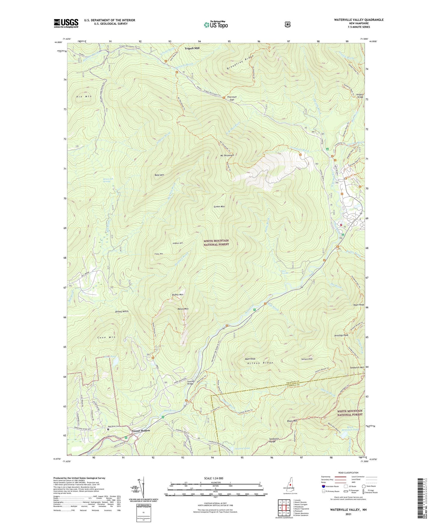
2021 topographic map quadrangle Waterville Valley in the state of New Hampshire. Scale: 1:24000. Based on the newly updated USGS 7.5' US Topo map series, this map is in the following counties: Grafton, Carroll. The map contains contour data, water features, and other items you are used to seeing on USGS maps, but also has updated roads and other features. This is the next generation of topographic maps. Printed on high-quality waterproof paper with UV fade-resistant inks.
Quads adjacent to this one:
West: Woodstock
Northwest: Lincoln
North: Mount Osceola
Northeast: Mount Carrigain
East: Mount Tripyramid
Southeast: Center Sandwich
South: Squam Mountains
Southwest: Plymouth
Contains the following named places: Acteon Ridge, Algonquin Trail, Atwood Pond, Bald Knob, Bald Mountain, Black Mountain, Black Mountain Pond, Black Mountain Pond Shelter, Boulder Path, Breadtray Ridge, Brown Ash Swamp, Cascade Brook, Chickenboro Brook, Clear Brook, Cone Mountain, Cone Pond, Dickey Mountain, Dickey Mountain Trail, Dickey Notch, Dry Brook, East Pond Brook, Fisher Mountain, Goose Hollow, Green Mountain, Hardy Brook, Hazelton Brook, High Brook, Hix Mountain, Hogback Mountain, Jennings Peak, Knights Bridge, Little East Pond Brook, Mack Brook, Mad River Cemetery, Mad River School, Mount Tecumseh, Mount Tecumseh Ski Area, Mount Tecumseh Trail, Noon Peak, Osceola Brook, Sachem Peak, Shattuck Brook, Shell Cascade, Sixmile Bridge, Smarts Brook, Smarts Brook Trail, Snows Brook, Sosman Trail, Tecumseh Brook, Thornton Gap, Tripoli Civilian Conservation Corps Camp, Tripoli Mill, Waterville Campground, Waterville Forest Camp, Waterville Valley Fire Department, Waterville Valley Golf and Tennis Course, Waterville Valley Police Dept, Waterville Valley Ski Area, Waterville Valley Winter Sprorts Area, Welch Mountain, Welch Mountain Trail, West Branch Mad River, WVFM-FM (Campton)